Aubigné-sur-Layon | |
|---|---|
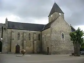 The church in Aubigné-sur-Layon | |
 Coat of arms | |
Location of Aubigné-sur-Layon | |
 Aubigné-sur-Layon  Aubigné-sur-Layon | |
| Coordinates: 47°12′46″N 0°27′35″W / 47.2128°N 0.4597°W | |
| Country | France |
| Region | Pays de la Loire |
| Department | Maine-et-Loire |
| Arrondissement | Angers |
| Canton | Chemillé-en-Anjou |
| Intercommunality | CC Loire Layon Aubance |
| Government | |
| • Mayor (2020–2026) | Pierre Robé[1] |
| Area 1 | 5.32 km2 (2.05 sq mi) |
| Population | 357 |
| • Density | 67/km2 (170/sq mi) |
| Time zone | UTC+01:00 (CET) |
| • Summer (DST) | UTC+02:00 (CEST) |
| INSEE/Postal code | 49012 /49540 |
| Elevation | 36–80 m (118–262 ft) (avg. 44 m or 144 ft) |
| 1 French Land Register data, which excludes lakes, ponds, glaciers > 1 km2 (0.386 sq mi or 247 acres) and river estuaries. | |
Aubigné-sur-Layon (French pronunciation: [obiɲe syʁ lɛjɔ̃] ⓘ, literally Aubigné on Layon) is a commune in the Maine-et-Loire department in western France.
Geography
The river Layon forms all of the commune's northern border.
Population
| Year | Pop. | ±% p.a. |
|---|---|---|
| 1968 | 324 | — |
| 1975 | 271 | −2.52% |
| 1982 | 257 | −0.75% |
| 1990 | 263 | +0.29% |
| 1999 | 334 | +2.69% |
| 2007 | 357 | +0.84% |
| 2012 | 363 | +0.33% |
| 2017 | 366 | +0.16% |
| Source: INSEE[3] | ||
See also
References
- ↑ "Répertoire national des élus: les maires" (in French). data.gouv.fr, Plateforme ouverte des données publiques françaises. 13 September 2022.
- ↑ "Populations légales 2021". The National Institute of Statistics and Economic Studies. 28 December 2023.
- ↑ Population en historique depuis 1968, INSEE
External links
Wikimedia Commons has media related to Aubigné-sur-Layon.
This article is issued from Wikipedia. The text is licensed under Creative Commons - Attribution - Sharealike. Additional terms may apply for the media files.