Vezins | |
|---|---|
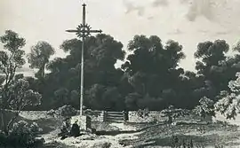 The cemetery of the martyrs of the battle of Ouleries | |
Location of Vezins | |
 Vezins  Vezins | |
| Coordinates: 47°07′15″N 0°42′37″W / 47.1208°N 0.7103°W | |
| Country | France |
| Region | Pays de la Loire |
| Department | Maine-et-Loire |
| Arrondissement | Cholet |
| Canton | Cholet-2 |
| Intercommunality | CA Choletais |
| Government | |
| • Mayor (2020–2026) | Cédric Van Vooren[1] |
| Area 1 | 18.36 km2 (7.09 sq mi) |
| Population | 1,741 |
| • Density | 95/km2 (250/sq mi) |
| Time zone | UTC+01:00 (CET) |
| • Summer (DST) | UTC+02:00 (CEST) |
| INSEE/Postal code | 49371 /49340 |
| Elevation | 113–184 m (371–604 ft) (avg. 140 m or 460 ft) |
| 1 French Land Register data, which excludes lakes, ponds, glaciers > 1 km2 (0.386 sq mi or 247 acres) and river estuaries. | |
Vezins (French pronunciation: [vəzɛ̃] ⓘ) is a commune in the Maine-et-Loire department in western France.
Geography
The Èvre river has its source in the commune, 1.5 km north east from the village itself.
Demography
| Year | Pop. | ±% p.a. |
|---|---|---|
| 1968 | 1,044 | — |
| 1975 | 1,073 | +0.39% |
| 1982 | 1,265 | +2.38% |
| 1990 | 1,394 | +1.22% |
| 1999 | 1,582 | +1.42% |
| 2007 | 1,642 | +0.47% |
| 2012 | 1,609 | −0.41% |
| 2017 | 1,717 | +1.31% |
| Source: INSEE[3] | ||
See also
References
- ↑ "Répertoire national des élus: les maires" (in French). data.gouv.fr, Plateforme ouverte des données publiques françaises. 4 May 2022.
- ↑ "Populations légales 2021". The National Institute of Statistics and Economic Studies. 28 December 2023.
- ↑ Population en historique depuis 1968, INSEE
External links
Wikimedia Commons has media related to Vezins.
This article is issued from Wikipedia. The text is licensed under Creative Commons - Attribution - Sharealike. Additional terms may apply for the media files.