Aubigny-lès-Sombernon | |
|---|---|
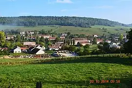
 A general view of Aubigny-lès-Sombernon | |
.svg.png.webp) Coat of arms | |
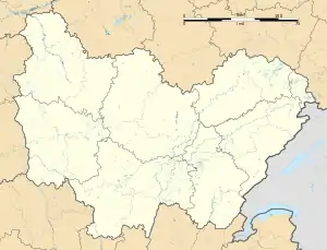
Location of Aubigny-lès-Sombernon | |
 Aubigny-lès-Sombernon  Aubigny-lès-Sombernon | |
| Coordinates: 47°18′19″N 4°38′38″E / 47.3053°N 4.6439°E | |
| Country | France |
| Region | Bourgogne-Franche-Comté |
| Department | Côte-d'Or |
| Arrondissement | Dijon |
| Canton | Talant |
| Intercommunality | CC Ouche Montagne |
| Government | |
| • Mayor (2020–2026) | Jean-Philippe Montuelle[1] |
| Area 1 | 7.93 km2 (3.06 sq mi) |
| Population | 164 |
| • Density | 21/km2 (54/sq mi) |
| Time zone | UTC+01:00 (CET) |
| • Summer (DST) | UTC+02:00 (CEST) |
| INSEE/Postal code | 21033 /21540 |
| Elevation | 395–551 m (1,296–1,808 ft) |
| 1 French Land Register data, which excludes lakes, ponds, glaciers > 1 km2 (0.386 sq mi or 247 acres) and river estuaries. | |
Aubigny-lès-Sombernon (French pronunciation: [obiɲi lɛ sɔ̃bɛʁnɔ̃], literally Aubigny near Sombernon) is a commune in the Côte-d'Or department in the Bourgogne-Franche-Comté region of eastern France.
Geography
Aubigny-lès-Sombernon is located some 33 km west of Dijon and 12 km north-east of Créancey. Access to the commune is by road D905 (Route de Paris) from Sombernon in the east passing through the commune and the village and continuing north-west to Grosbois-en-Montagne. The A38 autoroute passes through the south of the commune with Exit 27 for Civry-en-Montagne in the south-west of the commune and Exit 27 in the south-east of the commune which accesses the village. The D16L road goes south-west from the village to join the D16 which follows the A38 south-west. The commune has a band of forest from west to east through the middle of the commune south of the village and a smaller band of forest to the north with the rest of the commune farmland.[3]
The Brenne river flows through the commune and the village from the east and flows west into the Grosbois Reservoir west of the commune. The upper reach of the reservoir extends into the commune. The Ruisseau de Roussot flows from the south-east and joins the Brenne in the east of the commune.[3]
Neighbouring communes and villages
Heraldry
.svg.png.webp) Arms of Aubigny-lès-Sombernon |
Blazon: Gules, a lion of ermine.
|
Administration

List of Successive Mayors[4]
| From | To | Name |
|---|---|---|
| 2001 | 2008 | Daniel Hory |
| 2008 | 2014 | Henri Poulet |
| 2014 | 2020 | Valérie Sirugue-Labille |
| 2020 | 2026 | Jean-Philippe Montuelle |
Demography
In 2017 the commune had 150 inhabitants.
|
| ||||||||||||||||||||||||||||||||||||||||||||||||||||||||||||||||||||||||||||||||||||||||||||||||||||||||||||||||||
| Source: EHESS[5] and INSEE[6] | |||||||||||||||||||||||||||||||||||||||||||||||||||||||||||||||||||||||||||||||||||||||||||||||||||||||||||||||||||


Culture and heritage

Civil heritage
The commune has a number of buildings and structures that are registered as historical monuments:
Religious heritage


The commune has a number of religious buildings and structures that are registered as historical monuments:
- A Cemetery Cross (15th century)
 [11]
[11] - A Monumental Cross (15th century)
 [12]
[12] - The Parish Church of Saint-Paul (14th century)
 [13]
[13]
The Parish Church of Saint-Paul contains many items that are registered as historical objects:
- A Statue: Saint Roch (16th century)
 [14]
[14] - A Statue: Gabrielle of Rochechouart (16th century)
 [15]
[15] - A Reliquary (16th century)
 [16]
[16] - An Altar Cross (17th century)
 [17]
[17] - A Processional Staff (17th century)
 [18]
[18] - A Group Statue: The education of the Virgin (19th century)
 [19]
[19] - A Group Statuette: Saint Roch (16th century)
 [20]
[20] - A Statuette: Gabrielle of Rochechouart (16th century)
 [21]
[21] - A Statue: Virgin and Child (16th century)
 [22]
[22] - A Cross: Christ on the Cross (17th century)
 [23]
[23] - A Statue: Saint Blaise (16th century)
 [24]
[24] - A Statuette: Saint with open book (16th century)
 [25]
[25] - The Choir enclosure (19th century)
 [26]
[26]
See also
References
- ↑ "Répertoire national des élus: les maires". data.gouv.fr, Plateforme ouverte des données publiques françaises (in French). 2 December 2020.
- ↑ "Populations légales 2021". The National Institute of Statistics and Economic Studies. 28 December 2023.
- 1 2 3 Google Maps
- ↑ List of Mayors of France (in French)
- ↑ Des villages de Cassini aux communes d'aujourd'hui: Commune data sheet Aubigny-lès-Sombernon, EHESS (in French).
- ↑ Population en historique depuis 1968, INSEE
- ↑ Ministry of Culture, Mérimée IA00059850 Farmhouse (1) (in French)
- ↑ Ministry of Culture, Mérimée IA00059849 Farmhouse (2) (in French)
- ↑ Ministry of Culture, Mérimée IA00059851 Fortified Chateau (in French)
- ↑ Ministry of Culture, Mérimée IA00059848 2 Farmhouses (in French)
- ↑ Ministry of Culture, Mérimée PA00112074 Cemetery Cross (in French)
- ↑ Ministry of Culture, Mérimée IA00059772 Monumental Cross (in French)
- ↑ Ministry of Culture, Mérimée IA00059852 Parish Church of Saint-Paul (in French)
- ↑ Ministry of Culture, Palissy PM21000107 Statue: Saint Roch (in French)

- ↑ Ministry of Culture, Palissy PM21000106 Statue: Gabrielle of Rochechouart (in French)
- ↑ Ministry of Culture, Palissy IM21004354 Reliquary (in French)
- ↑ Ministry of Culture, Palissy IM21004353 Altar Cross (in French)
- ↑ Ministry of Culture, Palissy IM21004352 Processional Staff (in French)
- ↑ Ministry of Culture, Palissy IM21004351 Group Statue: The education of the Virgin (in French)
- ↑ Ministry of Culture, Palissy IM21004350 Group Statuette: Saint Roch (in French)
- ↑ Ministry of Culture, Palissy IM21004349 Statuette: Gabrielle of Rochechouart (in French)
- ↑ Ministry of Culture, Palissy IM21004348 Statue: Virgin and Child (in French)
- ↑ Ministry of Culture, Palissy IM21004347 Cross: Christ on the Cross (in French)
- ↑ Ministry of Culture, Palissy IM21004346 Statue: Saint Blaise (in French)
- ↑ Ministry of Culture, Palissy IM21004345 Statuette: Saint with open book (in French)
- ↑ Ministry of Culture, Palissy IM21004344 Choir enclosure (in French)
External links
- Aubigny-lès-Sombernon on the old IGN website (in French)
- Aubigny-lès-Sombernon on Géoportail, National Geographic Institute (IGN) website (in French)
- Aubigny on the 1750 Cassini Map