Baljuvon District
| |
|---|---|
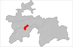 Baljuvon District Location in Tajikistan | |
| Coordinates: 38°18′N 69°41′E / 38.300°N 69.683°E | |
| Country | |
| Region | Khatlon Region |
| Capital | Baljuvon |
| Area | |
| • Total | 1,300 km2 (500 sq mi) |
| Population (2020) | |
| • Total | 30,400 |
| • Density | 23/km2 (61/sq mi) |
| • Ethnicities | |
| • Languages | Tajik |
| Time zone | UTC+5 |
| Area code | 735140 |
| Official languages | |
| Website | baljuvon |
Baljuvon District (Russian: Бальджуванский район; Tajik: Ноҳияи Балҷувон) is a district in Khatlon Region, Tajikistan. Its capital is the village Baljuvon. The population of Baljuvon District is 30,400 (January 2020 estimate).[2]
Administrative divisions
The district has an area of about 1,300 km2 (500 sq mi) and is divided administratively into five jamoats.[3] They are as follows:[4]
| Jamoat | Population (Jan. 2015)[4] |
|---|---|
| Safar Amirshoev | 5,785 |
| Baljuvon | 6,041 |
| Sayf Rahim | 7,305 |
| Sarikhosor | 5,894 |
| Tojikiston | 5,474 |
References
- ↑ "КОНСТИТУЦИЯ РЕСПУБЛИКИ ТАДЖИКИСТАН". prokuratura.tj. Parliament of Tajikistan. Retrieved 9 January 2020.
- ↑ "Population of the Republic of Tajikistan as of 1 January 2020" (PDF) (in Russian). Statistics office of Tajikistan. Archived from the original (PDF) on 1 June 2021. Retrieved 8 October 2020.
- ↑ "Regions of the Republic of Tajikistan 2017" (PDF) (in Russian). Statistics office of Tajikistan. pp. 16, 20. Archived from the original (PDF) on 28 March 2022. Retrieved 12 October 2020.
- 1 2 Jamoat-level basic indicators, United Nations Development Programme in Tajikistan, accessed 8 October 2020
Capital: Bokhtar | |||||||||||||||||||||||||||||||||||||||||||||||
|  | ||||||||||||||||||||||||||||||||||||||||||||||
|
| |||||||||||||||||||||||||||||||||||||||||||||||
| |||||||||||||||||||||||||||||||||||||||||||||||
This article is issued from Wikipedia. The text is licensed under Creative Commons - Attribution - Sharealike. Additional terms may apply for the media files.