Belfast | |
|---|---|
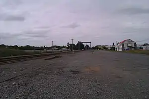 Former site of the Belfast railway station | |
| Coordinates: 43°27′S 172°38′E / 43.450°S 172.633°E | |
| Country | New Zealand |
| City | Christchurch |
| Local authority | Christchurch City Council |
| Electoral ward | Harewood |
| Community board | Waimāero Fendalton-Waimairi-Harewood |
| Area | |
| • Land | 598 ha (1,478 acres) |
| Population (June 2022)[2] | |
| • Total | 4,490 |
| (Waimakariri River) | Kainga | |
| (The Groynes) |
|
|
| Northwood | Bottle Lake |
Belfast (Māori: Purarekanui)[3] is a suburb of Christchurch, New Zealand. It is in the north of the city 10 km from Cathedral Square, close to the banks of the Waimakariri River.
History
Belfast is named after Belfast in Northern Ireland. It was originally known as North Road District, Seven Mile Peg, Styx, or by its Māori name Purarekanui.[3]
James McNeight Watt (1838–1892) emigrated from Belfast and was a partner with the original meat works, around which the settlement grew. Watt, who developed much of the area, is believed to have given it its present name.[4]
Demographics
Belfast, comprising the statistical areas of Belfast West and Belfast East, covers 5.98 km2 (2.31 sq mi).[1] It had an estimated population of 4,490 as of June 2022, with a population density of 751 people per km2.
| Year | Pop. | ±% p.a. |
|---|---|---|
| 2006 | 3,669 | — |
| 2013 | 3,900 | +0.88% |
| 2018 | 4,218 | +1.58% |
| Source: [5] | ||
Belfast had a population of 4,218 at the 2018 New Zealand census, an increase of 318 people (8.2%) since the 2013 census, and an increase of 549 people (15.0%) since the 2006 census. There were 1,632 households, comprising 2,091 males and 2,124 females, giving a sex ratio of 0.98 males per female, with 759 people (18.0%) aged under 15 years, 801 (19.0%) aged 15 to 29, 1,956 (46.4%) aged 30 to 64, and 705 (16.7%) aged 65 or older.
Ethnicities were 86.8% European/Pākehā, 11.7% Māori, 2.5% Pasifika, 6.4% Asian, and 2.9% other ethnicities. People may identify with more than one ethnicity.
The percentage of people born overseas was 17.0, compared with 27.1% nationally.
Although some people chose not to answer the census's question about religious affiliation, 54.5% had no religion, 33.4% were Christian, 0.3% had Māori religious beliefs, 1.1% were Hindu, 0.4% were Muslim, 0.7% were Buddhist and 2.2% had other religions.
Of those at least 15 years old, 441 (12.7%) people had a bachelor's or higher degree, and 855 (24.7%) people had no formal qualifications. 474 people (13.7%) earned over $70,000 compared to 17.2% nationally. The employment status of those at least 15 was that 1,812 (52.4%) people were employed full-time, 492 (14.2%) were part-time, and 129 (3.7%) were unemployed.[5]
| Name | Area (km2) | Population | Density (per km2) | Households | Median age | Median income |
|---|---|---|---|---|---|---|
| Belfast West | 3.10 | 1,908 | 615 | 729 | 41.2 years | $35,600[6] |
| Belfast East | 2.88 | 2,310 | 802 | 903 | 37.2 years | $33,400[7] |
| New Zealand | 37.4 years | $31,800 |
Economy
Belfast has a freezing works. The nearest shopping complex is at Northwood Supa Centre.
Education
Belfast School is a contributing primary school catering for years 1 to 8.[8] It had a roll of 441 as of April 2023.[9] The school opened in 1878.[10]
Sport
Belfast is home to the Belfast Rugby Club, which competes in the Christchurch rugby competition. The team's colours are green and gold. Its main sports ground is Sheldon Park. The northern end of the suburb houses light industry.
Notable people from Belfast
- Shane Bond (Former player for New Zealand Black Caps cricket team)
- Bill Bush (former All-Black) Now President Belfast Rugby Club (Cobras)
- Craig Green (former All Black)
- Jamie Nutbrown Former Canterbury Crusaders halfback, also a former Super Rugby referee.
- Wayne Smith (All Black's assistant coach)
- Mabel Whitaker (1884–1976), teacher and local historian.
References
![]() Media related to Belfast, New Zealand at Wikimedia Commons
Media related to Belfast, New Zealand at Wikimedia Commons
- 1 2 "ArcGIS Web Application". statsnz.maps.arcgis.com. Retrieved 6 September 2021.
- ↑ "Population estimate tables - NZ.Stat". Statistics New Zealand. Retrieved 25 October 2022.
- 1 2 Reed, A. W. (2010). Peter Dowling (ed.). Place Names of New Zealand. Rosedale, North Shore: Raupo. p. 45. ISBN 978-0-14-320410-7.
- ↑ Harper, Margaret (July 2011). "Christchurch Place Names" (PDF). Christchurch City Libraries. p. 21. Retrieved 1 October 2011.
- 1 2 "Statistical area 1 dataset for 2018 Census". Statistics New Zealand. March 2020. Belfast West (316900) and Belfast East (317300).
- ↑ 2018 Census place summary: Belfast West
- ↑ 2018 Census place summary: Belfast East
- ↑ Education Counts: Belfast School
- ↑ "New Zealand Schools Directory". New Zealand Ministry of Education. Retrieved 12 December 2022.
- ↑ "Local history resources - An annotated bibliography of published sources on the history of Christchurch, Lyttelton, and Banks Peninsula - Belfast School reunion: 120 years, 1878-1998" (PDF). Christchurch City Libraries. September 2014. p. 56.