| Walawe River | |
|---|---|
.JPG.webp) Downstream view of the river, from the Udawalawe Dam. | |
| Native name | වලවේ ගඟ (Sinhala) |
| Location | |
| Country | Sri Lanka |
| Locations | Padalangala, Mamadala, Nakulugamuwa, Uswewa, Angunakolapelessa, Tunkama, Ridiyagama |
| Physical characteristics | |
| Source | Sri Padaya |
| Mouth | Indian Ocean |
• location | Ambalantota |
• coordinates | 06°06′19″N 81°00′57″E / 6.10528°N 81.01583°E |
| Length | 138 km (86 mi) |
The Walawe (Sinhala: වලවේ ගඟ, Tamil: வளவை ஆறு) is a 138 km (86 mi)[1] long river in Sri Lanka which initiates from Adam's Peak. It meets the Indian Ocean at the coastal town of Ambalantota.
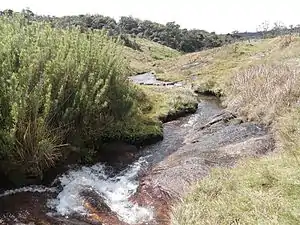
Belihul Oya, a major tributary to the Walawe River, near its source in Horton Plains.
See also
References
- ↑ "Walawe River". geoview.info. 20 December 2012. Retrieved 22 October 2015.
This article is issued from Wikipedia. The text is licensed under Creative Commons - Attribution - Sharealike. Additional terms may apply for the media files.