Berod bei Wallmerod | |
|---|---|
 | |
 Coat of arms | |
Location of Berod bei Wallmerod within Westerwaldkreis district 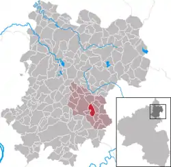 | |
 Berod bei Wallmerod 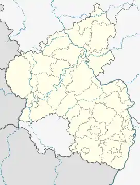 Berod bei Wallmerod | |
| Coordinates: 50°28′54″N 7°56′10″E / 50.48167°N 7.93611°E | |
| Country | Germany |
| State | Rhineland-Palatinate |
| District | Westerwaldkreis |
| Municipal assoc. | Wallmerod |
| Government | |
| • Mayor (2019–24) | Collin Schmidt[1] |
| Area | |
| • Total | 3.92 km2 (1.51 sq mi) |
| Elevation | 300 m (1,000 ft) |
| Population (2021-12-31)[2] | |
| • Total | 538 |
| • Density | 140/km2 (360/sq mi) |
| Time zone | UTC+01:00 (CET) |
| • Summer (DST) | UTC+02:00 (CEST) |
| Postal codes | 56414 |
| Dialling codes | 06435 |
| Vehicle registration | WW |
| Website | www.wallmerod.de |
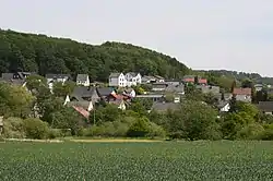
Berod bei Wallmerod is an Ortsgemeinde – a community belonging to a Verbandsgemeinde – in the Westerwaldkreis in Rhineland-Palatinate, Germany.
Geography
The community lies in the Westerwald between Montabaur and Wetzlar. Through the community from north to south flows the Eisenbach. The community belongs to the Verbandsgemeinde of Wallmerod, a kind of collective municipality.
History
In 1292, Berod had its first documentary mention as Berrinrode.
Politics
The municipal council is made up of 12 council members who were elected in a majority vote in the municipal election on 7 June 2009.
Economy and infrastructure
Right near the community runs Bundesstraße 8 linking Altenkirchen (Westerwald) and Limburg an der Lahn. The nearest Autobahn interchange is Diez on the A 3 (Cologne–Frankfurt am Main), some 10 km away. The nearest InterCityExpress stop is at the railway station at Montabaur on the Cologne-Frankfurt high-speed rail line.
References
- ↑ Direktwahlen 2019, Westerwaldkreis, Landeswahlleiter Rheinland-Pfalz, accessed 9 August 2021.
- ↑ "Bevölkerungsstand 2021, Kreise, Gemeinden, Verbandsgemeinden" (in German). Statistisches Landesamt Rheinland-Pfalz. 2022.
External links