Brandscheid | |
|---|---|
 | |
_COA.svg.png.webp) Coat of arms | |
Location of Brandscheid within Westerwaldkreis district 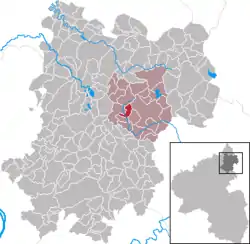 | |
 Brandscheid 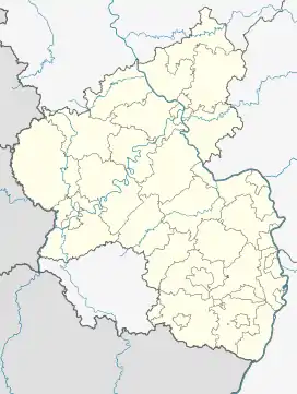 Brandscheid | |
| Coordinates: 50°33′39″N 7°55′13″E / 50.56083°N 7.92028°E | |
| Country | Germany |
| State | Rhineland-Palatinate |
| District | Westerwaldkreis |
| Municipal assoc. | Westerburg |
| Government | |
| • Mayor (2019–24) | Erhard Meutsch[1] |
| Area | |
| • Total | 3.03 km2 (1.17 sq mi) |
| Elevation | 420 m (1,380 ft) |
| Population (2021-12-31)[2] | |
| • Total | 470 |
| • Density | 160/km2 (400/sq mi) |
| Time zone | UTC+01:00 (CET) |
| • Summer (DST) | UTC+02:00 (CEST) |
| Postal codes | 56459 |
| Dialling codes | 02663 |
| Vehicle registration | WW |
| Website | www.brandscheid.de |
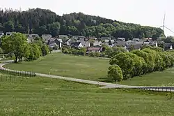
Brandscheid is an Ortsgemeinde – a community belonging to a Verbandsgemeinde – in the Westerwaldkreis in Rhineland-Palatinate, Germany.
Geography
Brandscheid lies on a mountain slope in the broad woodlands west of Westerburg. Since 1972 it has belonged to what was then the newly founded Verbandsgemeinde of Westerburg, a kind of collective municipality.
Economy and infrastructure
Northwest of the community runs Bundesstraße 255 leading from Montabaur to Herborn. The nearest Autobahn interchange is Montabaur on the A 3. The nearest InterCityExpress stop is the railway station at Montabaur on the Cologne-Frankfurt high-speed rail line.
References
- ↑ Direktwahlen 2019, Westerwaldkreis, Landeswahlleiter Rheinland-Pfalz, accessed 9 August 2021.
- ↑ "Bevölkerungsstand 2021, Kreise, Gemeinden, Verbandsgemeinden" (in German). Statistisches Landesamt Rheinland-Pfalz. 2022.
External links
This article is issued from Wikipedia. The text is licensed under Creative Commons - Attribution - Sharealike. Additional terms may apply for the media files.