Bethlehem Township | |
|---|---|
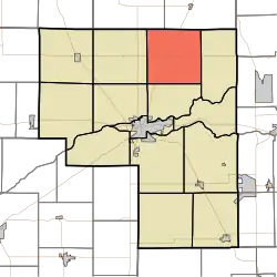 Location of Bethlehem Township in Cass County | |
| Coordinates: 40°52′03″N 86°18′13″W / 40.86750°N 86.30361°W | |
| Country | United States |
| State | Indiana |
| County | Cass |
| Government | |
| • Type | Indiana township |
| Area | |
| • Total | 35.36 sq mi (91.6 km2) |
| • Land | 35.31 sq mi (91.5 km2) |
| • Water | 0.04 sq mi (0.1 km2) |
| Elevation | 781 ft (238 m) |
| Population (2010) | |
| • Total | 795 |
| • Density | 22.5/sq mi (8.7/km2) |
| FIPS code | 18-05086[2] |
| GNIS feature ID | 453108 |
Bethlehem Township is one of fourteen townships in Cass County, Indiana. As of the 2010 census, its population was 795.[3]
History
Bethlehem Township was organized in 1836. It was named for an early settler's native hometown of Bethlehem, Pennsylvania.[4]
Geography
According to the 2010 census, the township has a total area of 35.36 square miles (91.6 km2), of which 35.31 square miles (91.5 km2) (or 99.86%) is land and 0.04 square miles (0.10 km2) (or 0.11%) is water.[3]
Unincorporated towns
Adjacent townships
- Liberty Township, Fulton County (northeast)
- Adams (east)
- Clay (south)
- Noble (southwest)
- Harrison (west)
- Wayne Township, Fulton County (northwest)
Major highways
References
- "Bethlehem Township, Cass County, Indiana". Geographic Names Information System. United States Geological Survey, United States Department of the Interior. Retrieved September 24, 2009.
- United States Census Bureau cartographic boundary files
- ↑ "US Board on Geographic Names". United States Geological Survey. October 25, 2007. Retrieved January 31, 2008.
- ↑ "U.S. Census website". United States Census Bureau. Retrieved January 31, 2008.
- 1 2 "Geographic Identifiers: 2010 Demographic Profile Data (G001): Bethlehem township, Cass County, Indiana". U.S. Census Bureau, American Factfinder. Archived from the original on February 12, 2020. Retrieved January 15, 2013.
- ↑ Helm, Thomas B. (1878). History of Cass County, Indiana. Kingman Bros. pp. 44.
External links
Wikimedia Commons has media related to Bethlehem Township, Cass County, Indiana.
Municipalities and communities of Cass County, Indiana, United States | ||
|---|---|---|
| City | Map of Indiana highlighting Cass County | |
| Towns | ||
| Townships | ||
| CDPs | ||
| Other communities | ||
| Footnotes | ‡This populated place also has portions in an adjacent county or counties | |
This article is issued from Wikipedia. The text is licensed under Creative Commons - Attribution - Sharealike. Additional terms may apply for the media files.