Betpouey | |
|---|---|
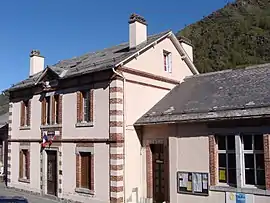 The town hall | |
.svg.png.webp) Coat of arms | |
Location of Betpouey | |
 Betpouey  Betpouey | |
| Coordinates: 42°52′57″N 0°02′02″E / 42.8825°N 0.0339°E | |
| Country | France |
| Region | Occitania |
| Department | Hautes-Pyrénées |
| Arrondissement | Argelès-Gazost |
| Canton | La Vallée des Gaves |
| Government | |
| • Mayor (2020–2026) | Bernard Souberbielle[1] |
| Area 1 | 16.2 km2 (6.3 sq mi) |
| Population | 82 |
| • Density | 5.1/km2 (13/sq mi) |
| Time zone | UTC+01:00 (CET) |
| • Summer (DST) | UTC+02:00 (CEST) |
| INSEE/Postal code | 65089 /65120 |
| Elevation | 899–2,854 m (2,949–9,364 ft) (avg. 1,250 m or 4,100 ft) |
| 1 French Land Register data, which excludes lakes, ponds, glaciers > 1 km2 (0.386 sq mi or 247 acres) and river estuaries. | |
Betpouey is a commune in the Hautes-Pyrénées department in southwestern France.
Geography
The Petite Baïse forms part of the commune's southwestern border, then flows north through the middle of the commune.
Population
| Year | Pop. | ±% |
|---|---|---|
| 1962 | 204 | — |
| 1968 | 226 | +10.8% |
| 1975 | 175 | −22.6% |
| 1982 | 160 | −8.6% |
| 1990 | 149 | −6.9% |
| 1999 | 128 | −14.1% |
| 2007 | 111 | −13.3% |
| 2009 | 109 | −1.8% |
See also
References
- ↑ "Répertoire national des élus: les maires". data.gouv.fr, Plateforme ouverte des données publiques françaises (in French). 2 December 2020.
- ↑ "Populations légales 2021". The National Institute of Statistics and Economic Studies. 28 December 2023.
Wikimedia Commons has media related to Betpouey.
This article is issued from Wikipedia. The text is licensed under Creative Commons - Attribution - Sharealike. Additional terms may apply for the media files.