Estaing | |
|---|---|
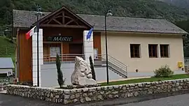 The town hall | |
.svg.png.webp) Coat of arms | |
Location of Estaing | |
 Estaing  Estaing | |
| Coordinates: 42°56′17″N 0°10′41″W / 42.9381°N 0.1781°W | |
| Country | France |
| Region | Occitania |
| Department | Hautes-Pyrénées |
| Arrondissement | Argelès-Gazost |
| Canton | La Vallée des Gaves |
| Intercommunality | Pyrénées Vallées des Gaves |
| Government | |
| • Mayor (2020–2026) | Marie-Luce Komeza[1] |
| Area 1 | 71.53 km2 (27.62 sq mi) |
| Population | 94 |
| • Density | 1.3/km2 (3.4/sq mi) |
| Time zone | UTC+01:00 (CET) |
| • Summer (DST) | UTC+02:00 (CEST) |
| INSEE/Postal code | 65169 /65400 |
| Elevation | 906–2,960 m (2,972–9,711 ft) (avg. 1,000 m or 3,300 ft) |
| 1 French Land Register data, which excludes lakes, ponds, glaciers > 1 km2 (0.386 sq mi or 247 acres) and river estuaries. | |
Estaing (French pronunciation: [ɛstɛ̃]; Occitan: Estanh) is a commune in the Hautes-Pyrénées department in south-western France.
See also
References
- ↑ "Répertoire national des élus: les maires" (in French). data.gouv.fr, Plateforme ouverte des données publiques françaises. 13 September 2022.
- ↑ "Populations légales 2021". The National Institute of Statistics and Economic Studies. 28 December 2023.
Wikimedia Commons has media related to Estaing (Hautes-Pyrénées).
This article is issued from Wikipedia. The text is licensed under Creative Commons - Attribution - Sharealike. Additional terms may apply for the media files.