| Big Lake State Park | |
|---|---|
 Big Lake and Big Lake State Park from the air | |
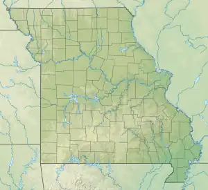
 Location in Missouri  Big Lake State Park (the United States) | |
| Location | Holt County, Missouri, United States |
| Coordinates | 40°05′05″N 95°20′35″W / 40.08472°N 95.34306°W[1] |
| Area | 407.41 acres (164.87 ha)[2] |
| Elevation | 860 ft (260 m)[1] |
| Established | 1932[3] |
| Visitors | 111,949 (in 2022)[4] |
| Governing body | Missouri Department of Natural Resources |
| Website | Big Lake State Park |
Big Lake State Park is a public recreation area located in northwest Missouri, United States. The 407-acre (165 ha) state park was established in 1932 at the northern end of the state's largest oxbow lake, Big Lake. Park activities include boating, camping, picnicking, fishing, and swimming.[5] Because park accommodations have been repeatedly destroyed by Missouri River floods, the park began using wheeled rental cabins that can be moved in the event of flooding in 2016.[6]
References
- 1 2 "Big Lake State Park". Geographic Names Information System. United States Geological Survey, United States Department of the Interior.
- ↑ "Big Lake State Park: Data Sheet" (PDF). Missouri Department of Natural Resources. November 2017. Retrieved April 25, 2018.
- ↑ "State Park Land Acquisition Summary". Missouri State Parks. Retrieved April 25, 2018.
- ↑ "Missouri State Park Attendance For January - December, 2022" (PDF). Missouri State Parks. February 3, 2023.
- ↑ "Big Lake State Park". Missouri Department of Natural Resources. Retrieved October 1, 2014.
- ↑ "Big Lake State Park opens portable cabins". St. Joseph News-Press. May 29, 2016. Retrieved May 29, 2016.
External links
- Big Lake State Park Missouri Department of Natural Resources
- Big Lake State Park Map Missouri Department of Natural Resources
This article is issued from Wikipedia. The text is licensed under Creative Commons - Attribution - Sharealike. Additional terms may apply for the media files.