Bonne | |
|---|---|
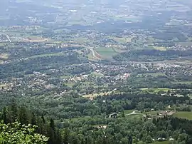 An aerial view of Bonne | |
 Coat of arms | |
Location of Bonne | |
 Bonne  Bonne | |
| Coordinates: 46°10′10″N 6°19′17″E / 46.1694°N 6.3214°E | |
| Country | France |
| Region | Auvergne-Rhône-Alpes |
| Department | Haute-Savoie |
| Arrondissement | Saint-Julien-en-Genevois |
| Canton | Gaillard |
| Intercommunality | Annemasse - Les Voirons Agglomération |
| Government | |
| • Mayor (2020–2026) | Yves Cheminal[1] |
| Area 1 | 8.58 km2 (3.31 sq mi) |
| Population | 3,269 |
| • Density | 380/km2 (990/sq mi) |
| Time zone | UTC+01:00 (CET) |
| • Summer (DST) | UTC+02:00 (CEST) |
| INSEE/Postal code | 74040 /74380 |
| Elevation | 459–1,303 m (1,506–4,275 ft) |
| Website | Bonne.fr |
| 1 French Land Register data, which excludes lakes, ponds, glaciers > 1 km2 (0.386 sq mi or 247 acres) and river estuaries. | |
Bonne (French pronunciation: [bɔn] ⓘ) is a commune in the Haute-Savoie department and Auvergne-Rhône-Alpes region of eastern France.
Population
| Year | Pop. | ±% p.a. |
|---|---|---|
| 1968 | 1,016 | — |
| 1975 | 1,314 | +3.74% |
| 1982 | 1,598 | +2.83% |
| 1990 | 1,815 | +1.60% |
| 1999 | 2,098 | +1.62% |
| 2007 | 2,599 | +2.71% |
| 2012 | 3,038 | +3.17% |
| 2017 | 3,218 | +1.16% |
| Source: INSEE[3] | ||
See also
References
- ↑ "Répertoire national des élus: les maires" (in French). data.gouv.fr, Plateforme ouverte des données publiques françaises. 13 September 2022.
- ↑ "Populations légales 2021". The National Institute of Statistics and Economic Studies. 28 December 2023.
- ↑ Population en historique depuis 1968, INSEE
Wikimedia Commons has media related to Bonne.
This article is issued from Wikipedia. The text is licensed under Creative Commons - Attribution - Sharealike. Additional terms may apply for the media files.