Margencel | |
|---|---|
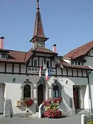 The town hall in Margencel | |
.svg.png.webp) Coat of arms | |
Location of Margencel | |
 Margencel  Margencel | |
| Coordinates: 46°20′20″N 6°25′58″E / 46.3389°N 6.4328°E | |
| Country | France |
| Region | Auvergne-Rhône-Alpes |
| Department | Haute-Savoie |
| Arrondissement | Thonon-les-Bains |
| Canton | Sciez |
| Intercommunality | Thonon Agglomération |
| Government | |
| • Mayor (2020–2026) | Patrick Bondaz[1] |
| Area 1 | 7.38 km2 (2.85 sq mi) |
| Population | 2,249 |
| • Density | 300/km2 (790/sq mi) |
| Time zone | UTC+01:00 (CET) |
| • Summer (DST) | UTC+02:00 (CEST) |
| INSEE/Postal code | 74163 /74200 |
| Elevation | 372–531 m (1,220–1,742 ft) |
| 1 French Land Register data, which excludes lakes, ponds, glaciers > 1 km2 (0.386 sq mi or 247 acres) and river estuaries. | |
Margencel (French pronunciation: [maʁʒɑ̃sɛl]; Arpitan: Mardanfé) is a commune in the Haute-Savoie department in the Auvergne-Rhône-Alpes region in south-eastern France.
Population
| Year | Pop. | ±% p.a. |
|---|---|---|
| 1968 | 660 | — |
| 1975 | 887 | +4.31% |
| 1982 | 1,035 | +2.23% |
| 1990 | 1,262 | +2.51% |
| 1999 | 1,429 | +1.39% |
| 2007 | 1,697 | +2.17% |
| 2012 | 1,945 | +2.77% |
| 2017 | 2,145 | +1.98% |
| Source: INSEE[3] | ||
Landmark
- St. Lawrence Church

St. Lawrence Church
See also
References
- ↑ "Répertoire national des élus: les maires" (in French). data.gouv.fr, Plateforme ouverte des données publiques françaises. 13 September 2022.
- ↑ "Populations légales 2021". The National Institute of Statistics and Economic Studies. 28 December 2023.
- ↑ Population en historique depuis 1968, INSEE
Wikimedia Commons has media related to Margencel.
This article is issued from Wikipedia. The text is licensed under Creative Commons - Attribution - Sharealike. Additional terms may apply for the media files.