Brand-Nagelberg | |
|---|---|
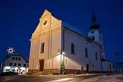 Church in Brand | |
 Coat of arms | |
 Brand-Nagelberg Location within Austria | |
| Coordinates: 48°50′N 14°59′E / 48.833°N 14.983°E | |
| Country | Austria |
| State | Lower Austria |
| District | Gmünd |
| Government | |
| • Mayor | Franz Freisehner |
| Area | |
| • Total | 36.64 km2 (14.15 sq mi) |
| Elevation | 508 m (1,667 ft) |
| Population (2018-01-01)[2] | |
| • Total | 1,546 |
| • Density | 42/km2 (110/sq mi) |
| Time zone | UTC+1 (CET) |
| • Summer (DST) | UTC+2 (CEST) |
| Postal code | 3871 |
| Area code | 02859 |
| Website | www.brand-nagelberg.at |
Brand-Nagelberg is a town in the district of Gmünd in the Austrian state of Lower Austria.
Geography
Brand-Nagelberg lies in the Waldviertel in Lower Austria. About 68.22 percent of the municipality is forested.
References
- ↑ "Dauersiedlungsraum der Gemeinden Politischen Bezirke und Bundesländer - Gebietsstand 1.1.2018". Statistics Austria. Retrieved 10 March 2019.
- ↑ "Einwohnerzahl 1.1.2018 nach Gemeinden mit Status, Gebietsstand 1.1.2018". Statistics Austria. Retrieved 9 March 2019.
External links
Neighboring municipalities | ||||||||||||||||
|---|---|---|---|---|---|---|---|---|---|---|---|---|---|---|---|---|
| ||||||||||||||||
This article is issued from Wikipedia. The text is licensed under Creative Commons - Attribution - Sharealike. Additional terms may apply for the media files.