Haugschlag | |
|---|---|
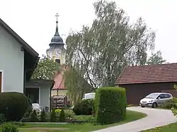 Haugschlag parish church | |
 Haugschlag Location within Austria | |
| Coordinates: 48°59′N 15°3′E / 48.983°N 15.050°E | |
| Country | Austria |
| State | Lower Austria |
| District | Gmünd |
| Government | |
| • Mayor | Adolf Kainz |
| Area | |
| • Total | 22.65 km2 (8.75 sq mi) |
| Elevation | 585 m (1,919 ft) |
| Population (2018-01-01)[2] | |
| • Total | 485 |
| • Density | 21/km2 (55/sq mi) |
| Time zone | UTC+1 (CET) |
| • Summer (DST) | UTC+2 (CEST) |
| Postal code | 3874 |
| Area code | 02865 |
| Website | www.haugschlag.at |
Haugschlag is a municipality in the district of Gmünd in the Austrian state of Lower Austria.
Geography
It is Austria's northernmost municipality, located in the Waldviertel region close to the Czech border. It comprises the Katastralgemeinden of Griesbach, Haugschlag, Rottal, and Türnau.
References
- ↑ "Dauersiedlungsraum der Gemeinden Politischen Bezirke und Bundesländer - Gebietsstand 1.1.2018". Statistics Austria. Retrieved 10 March 2019.
- ↑ Population at the beginning of the year for municipalities since 2002 (in German), Statistics Austria, January 2023, Wikidata Q27838750
External links
This article is issued from Wikipedia. The text is licensed under Creative Commons - Attribution - Sharealike. Additional terms may apply for the media files.