Bucy-Saint-Liphard | |
|---|---|
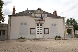 The town hall in Bucy-Saint-Liphard | |
.svg.png.webp) Coat of arms | |
Location of Bucy-Saint-Liphard | |
 Bucy-Saint-Liphard  Bucy-Saint-Liphard | |
| Coordinates: 47°56′12″N 1°45′57″E / 47.9367°N 1.7658°E | |
| Country | France |
| Region | Centre-Val de Loire |
| Department | Loiret |
| Arrondissement | Orléans |
| Canton | Meung-sur-Loire |
| Government | |
| • Mayor (2020–2026) | Yves Pinsard[1] |
| Area 1 | 17.84 km2 (6.89 sq mi) |
| Population | 202 |
| • Density | 11/km2 (29/sq mi) |
| Time zone | UTC+01:00 (CET) |
| • Summer (DST) | UTC+02:00 (CEST) |
| INSEE/Postal code | 45059 /45140 |
| Elevation | 105–131 m (344–430 ft) |
| 1 French Land Register data, which excludes lakes, ponds, glaciers > 1 km2 (0.386 sq mi or 247 acres) and river estuaries. | |
Bucy-Saint-Liphard (French pronunciation: [bysi sɛ̃ lifaʁ]) is a commune in the Loiret department in north-central France.
Population
| Year | Pop. | ±% p.a. |
|---|---|---|
| 1968 | 170 | — |
| 1975 | 245 | +5.36% |
| 1982 | 231 | −0.84% |
| 1990 | 227 | −0.22% |
| 1999 | 217 | −0.50% |
| 2009 | 206 | −0.52% |
| 2014 | 200 | −0.59% |
| 2020 | 191 | −0.76% |
| Source: INSEE[3] | ||
See also
References
- ↑ "Répertoire national des élus: les maires". data.gouv.fr, Plateforme ouverte des données publiques françaises (in French). 2 December 2020.
- ↑ "Populations légales 2021". The National Institute of Statistics and Economic Studies. 28 December 2023.
- ↑ Population en historique depuis 1968, INSEE
Wikimedia Commons has media related to Bucy-Saint-Liphard.
This article is issued from Wikipedia. The text is licensed under Creative Commons - Attribution - Sharealike. Additional terms may apply for the media files.