Le Malesherbois | |
|---|---|
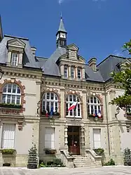 The town hall in Malesherbes | |
Location of Le Malesherbois | |
 Le Malesherbois  Le Malesherbois | |
| Coordinates: 48°17′46″N 2°24′58″E / 48.296°N 2.416°E | |
| Country | France |
| Region | Centre-Val de Loire |
| Department | Loiret |
| Arrondissement | Pithiviers |
| Canton | Le Malesherbois |
| Government | |
| • Mayor (2020–2026) | Hervé Gaurat[1] |
| Area 1 | 85.04 km2 (32.83 sq mi) |
| Population | 8,005 |
| • Density | 94/km2 (240/sq mi) |
| Time zone | UTC+01:00 (CET) |
| • Summer (DST) | UTC+02:00 (CEST) |
| INSEE/Postal code | 45191 /45330, 45300 |
| 1 French Land Register data, which excludes lakes, ponds, glaciers > 1 km2 (0.386 sq mi or 247 acres) and river estuaries. | |
Le Malesherbois (French pronunciation: [lə malzɛʁbwa]) is a commune in the Loiret department of north-central France. The municipality was established on 1 January 2016 by merger of the former communes of Malesherbes, Coudray, Labrosse, Mainvilliers, Manchecourt, Nangeville and Orveau-Bellesauve.[3]
Population
| Year | Pop. | ±% p.a. |
|---|---|---|
| 1968 | 4,148 | — |
| 1975 | 5,109 | +3.02% |
| 1982 | 6,259 | +2.94% |
| 1990 | 7,361 | +2.05% |
| 1999 | 7,675 | +0.47% |
| 2007 | 7,867 | +0.31% |
| 2012 | 8,121 | +0.64% |
| 2017 | 8,201 | +0.20% |
| Source: INSEE[4] | ||
See also
References
Wikimedia Commons has media related to Le Malesherbois.
- ↑ "Répertoire national des élus: les maires" (in French). data.gouv.fr, Plateforme ouverte des données publiques françaises. 13 September 2022.
- ↑ "Populations légales 2021". The National Institute of Statistics and Economic Studies. 28 December 2023.
- ↑ Arrêté préfectoral 30 November 2015 (in French)
- ↑ Population en historique depuis 1968, INSEE
This article is issued from Wikipedia. The text is licensed under Creative Commons - Attribution - Sharealike. Additional terms may apply for the media files.