22nd District of Budapest
Budapest XXII. kerülete Budafok-Tétény | |
|---|---|
| District XXII | |
 Flag  Coat of arms | |
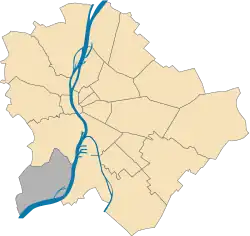 Location of District XXII in Budapest (shown in grey) | |
| Coordinates: 47°25′30″N 19°01′54″E / 47.4250°N 19.0317°E | |
| Country | Hungary |
| Region | Central Hungary |
| City | Budapest |
| Established | 1 January 1950 |
| Quarters[1] | List
|
| Government | |
| • Mayor | Ferenc Karsay (Fidesz-KDNP) |
| Area | |
| • Total | 34.75 km2 (13.42 sq mi) |
| • Rank | 6th |
| Population (2016)[2] | |
| • Total | 54,611 |
| • Rank | 18th |
| • Density | 1,571/km2 (4,070/sq mi) |
| Demonym | huszonkettedik kerületi ("22nd districter") |
| Time zone | UTC+1 (CET) |
| • Summer (DST) | UTC+2 (CEST) |
| Postal code | 1221 ... 1225 |
| Website | budafokteteny |
Budafok-Tétény the 22nd district of Budapest, Hungary.
List of mayors
| Member | Party | Date | |
|---|---|---|---|
| Ervin Hajas | SZDSZ | 1990–1998 | |
| Ind. | |||
| Attila Szabolcs | MDF | 1998–2002 | |
| Istvánné Bollók | MSZP | 2002–2006 | |
| Attila Szabolcs | Fidesz | 2006–2014 | |
| Ferenc Karsay | Fidesz | 2014– | |
Twin towns - twin cities
References
- ↑ "94/2012. (XII. 27.) Főv. Kgy. rendelet - a közterület- és városrésznevek megállapításáról, azok jelöléséről, valamint a házszám-megállapítás szabályairól" (in Hungarian).
- 1 2 "A fővárosi kerületek, a megyei jogú városok, a városok területe, lakónépessége és a lakások száma" [The area of districts of the capital, of the towns with county's rights, resident population and number of dwellings]. Magyarország közigazgatási helynévkönyve 2016. január 1 [Gazetteer of Hungary 1 January 2016] (PDF). Hungarian Central Statistical Office. 2016. p. 21.
External links
Wikimedia Commons has media related to Budapest District XXII.
|  | |
This article is issued from Wikipedia. The text is licensed under Creative Commons - Attribution - Sharealike. Additional terms may apply for the media files.