Burnside | |
|---|---|
 Burnside Park | |
| Coordinates: 43°29′59″S 172°34′07″E / 43.499857°S 172.568658°E | |
| Country | New Zealand |
| City | Christchurch |
| Local authority | Christchurch City Council |
| Electoral ward |
|
| Community board | Waimāero Fendalton-Waimairi-Harewood |
| Area | |
| • Land | 457 ha (1,129 acres) |
| Population (June 2023)[2] | |
| • Total | 9,420 |
| Harewood | Bishopdale | |
|
|
Bryndwr | |
| Avonhead | Ilam | Fendalton |
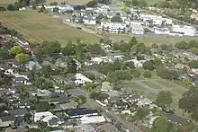
Burnside is a suburb of Christchurch, New Zealand, located southeast of Christchurch International Airport. As with most suburbs in Christchurch, it has no defined boundaries and is a general area.
History
Burnside was originally part of a farm, approximately 1,700 acres (6.9 km2) in size, owned by the early settler William Boag (1828-1904), who arrived in 1851 from Perthshire. It was named for the small creeks that formed the headwaters of the Waimairi Stream.[3][4] The name Burnside was made official by the Waimairi County Council in 1959,[5] although Burnside Road had been renamed Memorial Avenue in 1950.[6]
For the first hundred years of European settlement, the area in and around Burnside was farmland, with sheep, cattle and orchards occupying the land.
Demographics
Burnside, comprising the statistical areas of Burnside, Burnside Park and Russley, covers 4.57 km2 (1.76 sq mi).[1] It had an estimated population of 9,420 as of June 2023, with a population density of 2,061 people per km2.
| Year | Pop. | ±% p.a. |
|---|---|---|
| 2006 | 7,191 | — |
| 2013 | 7,335 | +0.28% |
| 2018 | 7,713 | +1.01% |
| Source: [7] | ||
Burnside had a population of 7,713 at the 2018 New Zealand census, an increase of 378 people (5.2%) since the 2013 census, and an increase of 522 people (7.3%) since the 2006 census. There were 2,712 households, comprising 3,810 males and 3,903 females, giving a sex ratio of 0.98 males per female, with 1,458 people (18.9%) aged under 15 years, 1,683 (21.8%) aged 15 to 29, 3,372 (43.7%) aged 30 to 64, and 1,200 (15.6%) aged 65 or older.
Ethnicities were 70.2% European/Pākehā, 7.2% Māori, 2.9% Pasifika, 24.6% Asian, and 3.1% other ethnicities. People may identify with more than one ethnicity.
The percentage of people born overseas was 32.6, compared with 27.1% nationally.
Although some people chose not to answer the census's question about religious affiliation, 47.9% had no religion, 39.1% were Christian, 0.2% had Māori religious beliefs, 1.4% were Hindu, 1.6% were Muslim, 2.0% were Buddhist and 2.1% had other religions.
Of those at least 15 years old, 1,788 (28.6%) people had a bachelor's or higher degree, and 780 (12.5%) people had no formal qualifications. 1,185 people (18.9%) earned over $70,000 compared to 17.2% nationally. The employment status of those at least 15 was that 3,024 (48.3%) people were employed full-time, 1,023 (16.4%) were part-time, and 219 (3.5%) were unemployed.[7]
| Name | Area (km2) | Population | Density (per km2) | Households | Median age | Median income |
|---|---|---|---|---|---|---|
| Burnside | 1.36 | 3,489 | 2,565 | 1,209 | 36.1 years | $32,400[8] |
| Burnside Park | 1.34 | 3,243 | 2,420 | 1,104 | 37.2 years | $33,400[9] |
| Russley | 1.87 | 981 | 525 | 399 | 49.7 years | $37,400[10] |
| New Zealand | 37.4 years | $31,800 |
Schools

Burnside High School is a secondary school catering for years 9 to 13.[11] It has a roll of 2419. The school opened in 1960.[12]
Cobham Intermediate is an intermediate school catering for years 7 to 8.[13] It has a roll of 636. The school, initially named Fendalton Intermediate, opened in 1963.[14]
Burnside Primary School and Roydvale School are contributing primary schools catering for years 1 to 6.[15][16] They have rolls of 315 and 259, respectively. Burnside School opened in 1956, and Roydvale in 1967.[3] Kendal School, which opened in 1962,[3] closed in 2014.[17]
Christ the King School is a state-integrated Catholic primary school for years 1 to 8.[18] It has a roll of 317.
All these schools are coeducational, and all except Christ the King are state schools. Rolls are as of April 2023.[19]
Suburb
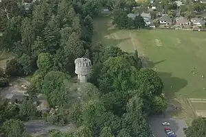
Burnside contains a central park (Burnside Park), and its two central roads are Memorial Avenue and Greers Road. It contains a smaller park (Jellie Park) opposite Burnside High School on Greers Road.
References
- 1 2 "ArcGIS Web Application". statsnz.maps.arcgis.com. Retrieved 7 September 2021.
- ↑ "Population estimate tables - NZ.Stat". Statistics New Zealand. Retrieved 25 October 2023.
- 1 2 3 "Bryndwr and Burnside". Christchurch City Libraries. Retrieved 30 September 2011.
- ↑ Reed, A. W. (2010). Peter Dowling (ed.). Place Names of New Zealand. Rosedale, North Shore: Raupo. p. 64. ISBN 978-0-14-320410-7.
- ↑ Harper, Margaret (July 2011). "Christchurch Place Names". Christchurch City Libraries. p. 36. Retrieved 30 September 2011.
- ↑ O’Connor, Paul (2009). Choosing the Right Path: Burnside High School 1960-2010. Christchurch: Silver Fox Publishing. p. 12. ISBN 978-0-473-15685-5.
- 1 2 "Statistical area 1 dataset for 2018 Census". Statistics New Zealand. March 2020. Burnside (319200), Burnside Park (318300) and Russley (317500).
- ↑ 2018 Census place summary: Burnside
- ↑ 2018 Census place summary: Burnside Park
- ↑ 2018 Census place summary: Russley
- ↑ Education Counts: Burnside High School
- ↑ O'Connor, Paul (2009). Choosing the Right Path: Burnside High School 1960–2010. Christchurch: Silver Fox Publishing. ISBN 978-0-473-15685-5.
- ↑ Education Counts: Cobham Intermediate School
- ↑ "Miscellaneous Local Historical Information" (PDF). Christchurch City Libraries. p. 47. Retrieved 7 September 2021.
- ↑ Education Counts: Burnside Primary School
- ↑ Education Counts: Roydvale School
- ↑ Parata, Hekia (20 June 2013). "Kendal School, Christchurch (3395) Closure Notice" (PDF). New Zealand Gazette. New Zealand Government. 2013 (78): 2138. Retrieved 7 September 2021.
- ↑ Education Counts: Christ the King School
- ↑ "New Zealand Schools Directory". New Zealand Ministry of Education. Retrieved 12 December 2022.