Bystrovany | |
|---|---|
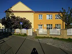 Primary school | |
 Flag  Coat of arms | |
 Bystrovany Location in the Czech Republic | |
| Coordinates: 49°35′49″N 17°19′25″E / 49.59694°N 17.32361°E | |
| Country | |
| Region | Olomouc |
| District | Olomouc |
| First mentioned | 1277 |
| Area | |
| • Total | 3.51 km2 (1.36 sq mi) |
| Elevation | 231 m (758 ft) |
| Population (2023-01-01)[1] | |
| • Total | 991 |
| • Density | 280/km2 (730/sq mi) |
| Time zone | UTC+1 (CET) |
| • Summer (DST) | UTC+2 (CEST) |
| Postal code | 779 00 |
| Website | www |
Bystrovany is a municipality and village in Olomouc District in the Olomouc Region of the Czech Republic. It has about 1,000 inhabitants.
Bystrovany lies approximately 5 kilometres (3 mi) east of Olomouc and 216 km (134 mi) east of Prague.
Notable people
- Jarmila Šťastná (1932–2015), speed skater and figure skater
References
Wikimedia Commons has media related to Bystrovany.
This article is issued from Wikipedia. The text is licensed under Creative Commons - Attribution - Sharealike. Additional terms may apply for the media files.