Horní Loděnice | |
|---|---|
 Church of Saint Isidore | |
 Flag  Coat of arms | |
 Horní Loděnice Location in the Czech Republic | |
| Coordinates: 49°46′16″N 17°22′38″E / 49.77111°N 17.37722°E | |
| Country | |
| Region | Olomouc |
| District | Olomouc |
| First mentioned | 1296 |
| Area | |
| • Total | 18.19 km2 (7.02 sq mi) |
| Elevation | 543 m (1,781 ft) |
| Population (2023-01-01)[1] | |
| • Total | 340 |
| • Density | 19/km2 (48/sq mi) |
| Time zone | UTC+1 (CET) |
| • Summer (DST) | UTC+2 (CEST) |
| Postal code | 783 05 |
| Website | www |
Horní Loděnice (until 1950 Německá Loděnice; German: Deutsch Lodenitz) is a municipality and village in Olomouc District in the Olomouc Region of the Czech Republic. It has about 300 inhabitants.
Horní Loděnice lies approximately 22 kilometres (14 mi) north-east of Olomouc and 214 km (133 mi) east of Prague.
Gallery
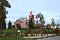
 Playground and municipal office
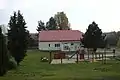
 Road
Road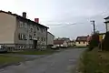 Houses
References
Wikimedia Commons has media related to Horní Loděnice.
This article is issued from Wikipedia. The text is licensed under Creative Commons - Attribution - Sharealike. Additional terms may apply for the media files.