| Scottish Gaelic name | Cealasaigh |
|---|---|
| Old Norse name | Unknown |
| Location | |
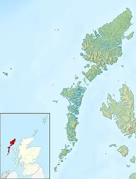
 Cealasaigh Cealasaigh shown within the Outer Hebrides | |
| OS grid reference | NB146418 |
| Coordinates | 58°18′N 6°52′W / 58.3°N 6.87°W |
| Physical geography | |
| Island group | Outer Hebrides |
| Area | <10 ha |
| Highest elevation | 25 metres (82 ft) |
| Administration | |
| Sovereign state | United Kingdom |
| Country | Scotland |
| Council area | Comhairle nan Eilean Siar |
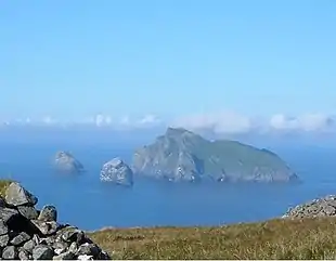
Cealasaigh or Kealasay is an islet in outer Loch Ròg, Lewis, Scotland that lies north of Traigh Mhór on Little Bernera and south of Campaigh.
To the west is the islet of Eilean Fir Chrothair (isle of the shepherd) and Sgeir na h-Aon Chaorach (lone sheep rock) lies to the east.[1][2]
Notes
- ↑ Haswell-Smith, Hamish (2004). The Scottish Islands. Edinburgh: Canongate. p. 312. ISBN 978-1-84195-454-7.
- ↑ "Get-a-map" Archived 29 June 2011 at the Wayback Machine. Ordnance Survey. Retrieved 24 July 2010.
58°16′19″N 6°52′13″W / 58.2719°N 6.8702°W
This article is issued from Wikipedia. The text is licensed under Creative Commons - Attribution - Sharealike. Additional terms may apply for the media files.
