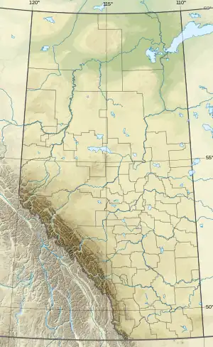
Chipewyan Lake | |
|---|---|
 Chipewyan Lake Location of Chipewyan Lake in M.D. of Opportunity  Chipewyan Lake Location of Chipewyan Lake in Alberta  Chipewyan Lake Location of Chipewyan Lake in Canada | |
| Coordinates: 56°56′25″N 113°28′24″W / 56.94028°N 113.47333°W | |
| Country | Canada |
| Province | Alberta |
| Region | Northern Alberta |
| Census division | 17 |
| Municipal district | Municipal District of Opportunity No. 17 |
| Government | |
| • Type | Unincorporated |
| • Governing body | Municipal District of Opportunity No. 17 Council |
| Area (2021)[1] | |
| • Land | 4.29 km2 (1.66 sq mi) |
| Population (2021)[1] | |
| • Total | 72 |
| • Density | 16.8/km2 (44/sq mi) |
| Time zone | UTC−07:00 (MST) |
| • Summer (DST) | UTC−06:00 (MDT) |
| Area code(s) | 780, 587, 825 |
Chipewyan Lake is an unincorporated community in northern Alberta within the Municipal District of Opportunity No. 17. It is located on the southern shore of Chipewyan Lake approximately 110 kilometres (68 mi) north of Wabasca and 128 kilometres (80 mi) west of Fort McMurray. The community is not accessible by Alberta's provincial highway system. It is however accessible by using the Laricina Energy/Shell Canada S-4 access road.
Chipewyan Lake was placed under mandatory evacuation order on May 30, 2019, due to out-of-control wildfires in the area.[2] It was placed under another mandatory evacuation order on May 14, 2023 due to an out-of-control wildfire north of the community.[3]
Demographics
In the 2021 Census of Population conducted by Statistics Canada, Chipewyan Lake had a population of 72 living in 22 of its 28 total private dwellings, a change of -16.3% from its 2016 population of 86. With a land area of 4.29 km2 (1.66 sq mi), it had a population density of 16.8/km2 (43.5/sq mi) in 2021.[1]
As a designated place in the 2016 Census of Population conducted by Statistics Canada, Chipewyan Lake had a population of 0 living in 2 of its 6 total private dwellings, a change of -100% from its 2011 population of 38. With a land area of 2.39 km2 (0.92 sq mi), it had a population density of 0.0/km2 (0.0/sq mi) in 2016.[4]
See also
References
- 1 2 3 "Population and dwelling counts: Canada and designated places". Statistics Canada. February 9, 2022. Retrieved February 10, 2022.
- ↑ "Wildfires force more evacuations in remote northern Alberta communities". CBC News. May 30, 2019. Retrieved May 30, 2019.
- ↑ "This is an Alberta Emergency Alert. Chipewyan Lake has issued an Evacuation Order due to wildfire". www.alberta.ca. Retrieved May 15, 2023.
- ↑ "Population and dwelling counts, for Canada, provinces and territories, and designated places, 2016 and 2011 censuses – 100% data (Alberta)". Statistics Canada. February 8, 2017. Retrieved February 13, 2017.