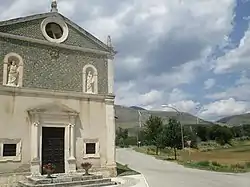
Collarmele | |
|---|---|
| Comune di Collarmele | |
 | |
Location of Collarmele | |
 Collarmele Location of Collarmele in Italy 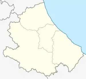 Collarmele Collarmele (Abruzzo) | |
| Coordinates: 42°3′36″N 13°37′36″E / 42.06000°N 13.62667°E | |
| Country | Italy |
| Region | Abruzzo |
| Province | L'Aquila (AQ) |
| Frazioni | Aielli, Celano, Cerchio, Pescina, San Benedetto dei Marsi |
| Area | |
| • Total | 23.71 km2 (9.15 sq mi) |
| Elevation | 835 m (2,740 ft) |
| Population (31 December 2013)[2] | |
| • Total | 921 |
| • Density | 39/km2 (100/sq mi) |
| Demonym | Collarmelesi |
| Time zone | UTC+1 (CET) |
| • Summer (DST) | UTC+2 (CEST) |
| Postal code | 67040 |
| Dialing code | 0863 |
| ISTAT code | 066038 |
| Patron saint | Santa Felicita |
| Saint day | 10 July |
Collarmele is a comune and town in the Province of L'Aquila in the Abruzzo region of Italy
References
- ↑ "Superficie di Comuni Province e Regioni italiane al 9 ottobre 2011". Italian National Institute of Statistics. Retrieved 16 March 2019.
- ↑ All demographics and other statistics from the Italian statistical institute (Istat)
This article is issued from Wikipedia. The text is licensed under Creative Commons - Attribution - Sharealike. Additional terms may apply for the media files.