| Crichton | |
|---|---|
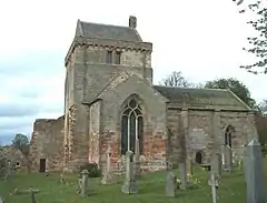
 The former collegiate church at Crichton | |
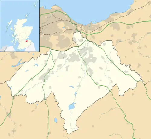
 Crichton Location within Midlothian | |
| OS grid reference | NT384619 |
| Council area | |
| Lieutenancy area | |
| Country | Scotland |
| Sovereign state | United Kingdom |
| Post town | PATHHEAD |
| Postcode district | EH37 |
| Dialling code | 01875 |
| Police | Scotland |
| Fire | Scottish |
| Ambulance | Scottish |
| UK Parliament | |
| Scottish Parliament | |
Crichton is a small village and civil parish in Midlothian, Scotland, around 2 miles (3 km) south of Pathhead and the same distance east of Gorebridge.
The second element of the name is clearly from the Old English word tūn 'farm, settlement'.[1] The first element is less certain, however, and could be from Gaelic crioch 'border'[2] or Cumbric craig 'rock'.[3]
To the west of the village is the 15th-century parish church, formerly a collegiate church, established by William Crichton, 1st Lord Crichton, the Lord Chancellor of Scotland from 1439 to 1453. To the south of the church is Crichton Castle, begun in the late 14th century by William's father John de Crichton and featuring a fine 16th-century Italianate courtyard façade.
The civil parish has a population of 1,223 in 2011.[4]
See also
References
- ↑ Bethany Fox, 'The P-Celtic Place-Names of North-East England and South-East Scotland', The Heroic Age, 10 (2007), http://www.heroicage.org/issues/10/fox.html (appendix at http://www.heroicage.org/issues/10/fox-appendix.html).
- ↑ Patrick Hanks; Flavia Hodges. A Dictionary of Surnames. Oxford University Press.
- ↑ Bethany Fox, 'The P-Celtic Place-Names of North-East England and South-East Scotland', The Heroic Age, 10 (2007), http://www.heroicage.org/issues/10/fox.html (appendix at http://www.heroicage.org/issues/10/fox-appendix.html).
- ↑ Census of Scotland 2011, Table KS101SC – Usually Resident Population, publ. by National Records of Scotland. Web site http://www.scotlandscensus.gov.uk/ retrieved March 2016. See “Standard Outputs”, Table KS101SC, Area type: Civil Parish 1930
External links