Cristot | |
|---|---|
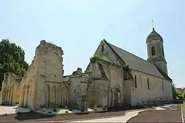 The church in Cristot | |
Location of Cristot | |
 Cristot  Cristot | |
| Coordinates: 49°11′43″N 0°34′46″W / 49.1953°N 0.5794°W | |
| Country | France |
| Region | Normandy |
| Department | Calvados |
| Arrondissement | Bayeux |
| Canton | Thue et Mue |
| Intercommunality | Seulles Terre et Mer |
| Government | |
| • Mayor (2020–2026) | Sylvie Le Bugle[1] |
| Area 1 | 3.92 km2 (1.51 sq mi) |
| Population | 220 |
| • Density | 56/km2 (150/sq mi) |
| Time zone | UTC+01:00 (CET) |
| • Summer (DST) | UTC+02:00 (CEST) |
| INSEE/Postal code | 14205 /14250 |
| Elevation | 66–106 m (217–348 ft) (avg. 100 m or 330 ft) |
| 1 French Land Register data, which excludes lakes, ponds, glaciers > 1 km2 (0.386 sq mi or 247 acres) and river estuaries. | |
Cristot is a commune in the Calvados department and Normandy region of north-western France.
Population
| Year | Pop. | ±% p.a. |
|---|---|---|
| 1968 | 146 | — |
| 1975 | 142 | −0.40% |
| 1982 | 133 | −0.93% |
| 1990 | 152 | +1.68% |
| 1999 | 160 | +0.57% |
| 2009 | 215 | +3.00% |
| 2014 | 209 | −0.56% |
| 2020 | 218 | +0.71% |
| Source: INSEE[3] | ||
See also
References
- ↑ "Répertoire national des élus: les maires". data.gouv.fr, Plateforme ouverte des données publiques françaises (in French). 2 December 2020.
- ↑ "Populations légales 2021". The National Institute of Statistics and Economic Studies. 28 December 2023.
- ↑ Population en historique depuis 1968, INSEE
Wikimedia Commons has media related to Cristot.
This article is issued from Wikipedia. The text is licensed under Creative Commons - Attribution - Sharealike. Additional terms may apply for the media files.