Le Détroit | |
|---|---|
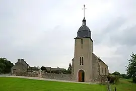 The church in Le Détroit | |
.svg.png.webp) Coat of arms | |
Location of Le Détroit | |
 Le Détroit  Le Détroit | |
| Coordinates: 48°52′04″N 0°20′56″W / 48.8678°N 0.3489°W | |
| Country | France |
| Region | Normandy |
| Department | Calvados |
| Arrondissement | Caen |
| Canton | Falaise |
| Intercommunality | Pays de Falaise |
| Government | |
| • Mayor (2020–2026) | Gilbert Dufay[1] |
| Area 1 | 5.52 km2 (2.13 sq mi) |
| Population | 90 |
| • Density | 16/km2 (42/sq mi) |
| Time zone | UTC+01:00 (CET) |
| • Summer (DST) | UTC+02:00 (CEST) |
| INSEE/Postal code | 14223 /14690 |
| Elevation | 89–251 m (292–823 ft) (avg. 200 m or 660 ft) |
| 1 French Land Register data, which excludes lakes, ponds, glaciers > 1 km2 (0.386 sq mi or 247 acres) and river estuaries. | |
Le Détroit (French pronunciation: [lə detʁwa] ⓘ, literally "The Strait") is a commune in the Calvados department in the Normandy region in northwestern France.
The commune is part of the area known as Suisse Normande.[3]
Population
| Year | Pop. | ±% p.a. |
|---|---|---|
| 1968 | 99 | — |
| 1975 | 83 | −2.49% |
| 1982 | 76 | −1.25% |
| 1990 | 82 | +0.95% |
| 1999 | 90 | +1.04% |
| 2007 | 87 | −0.42% |
| 2012 | 90 | +0.68% |
| 2017 | 87 | −0.68% |
| Source: INSEE[4] | ||
See also
References
- ↑ "Répertoire national des élus: les maires". data.gouv.fr, Plateforme ouverte des données publiques françaises (in French). 2 December 2020.
- ↑ "Populations légales 2021". The National Institute of Statistics and Economic Studies. 28 December 2023.
- ↑ "Map of Suiss Normande" (PDF).
- ↑ Population en historique depuis 1968, INSEE
Wikimedia Commons has media related to Le Détroit.
This article is issued from Wikipedia. The text is licensed under Creative Commons - Attribution - Sharealike. Additional terms may apply for the media files.