Crouch Township | |
|---|---|
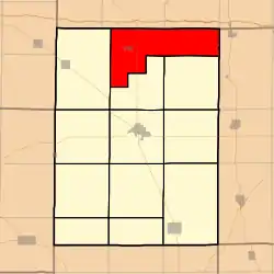 Location in Hamilton County | |
 Hamilton County's location in Illinois | |
| Coordinates: 38°13′32″N 88°30′03″W / 38.22556°N 88.50083°W | |
| Country | |
| State | |
| County | Hamilton |
| Established | November 3, 1885 |
| Area | |
| • Total | 25.09 sq mi (65.0 km2) |
| • Land | 25.09 sq mi (65.0 km2) |
| • Water | 0.01 sq mi (0.03 km2) 0.04% |
| Elevation | 377 ft (115 m) |
| Population (2010) | |
| • Estimate (2016)[1] | 360 |
| • Density | 10.4/sq mi (4.0/km2) |
| Time zone | UTC-6 (CST) |
| • Summer (DST) | UTC-5 (CDT) |
| ZIP codes | 62828, 62859, 62895 |
| FIPS code | 17-065-17809 |
Crouch Township is one of twelve townships in Hamilton County, Illinois, USA. As of the 2010 census, its population was 374 and it contained 175 housing units.[2]
As of the 2010 census, its population was 260 and it contained 119 housing units.[2] According to the 2010 census, the township has a total area of 25.09 square miles (65.0 km2), of which 25.09 square miles (65.0 km2) (or 100%) is land and 0.01 square miles (0.026 km2) (or 0.04%) is water.[2]
Geography
According to the 2010 census, the township has a total area of 47.45 square miles (122.9 km2), of which 47.44 square miles (122.9 km2) (or 99.98%) is land and 0.01 square miles (0.026 km2) (or 0.02%) is water.[2]
Cities, towns, villages
Unincorporated towns
- Aden at 38°14′30″N 88°27′30″W / 38.241715°N 88.458383°W
- Garrison at 38°14′54″N 88°31′09″W / 38.248381°N 88.519218°W
- Piopolis at 38°11′01″N 88°33′41″W / 38.183659°N 88.561442°W
(This list is based on USGS data and may include former settlements.)
Cemeteries
The township contains these three cemeteries: Crouch, Garrison and Rawls.
Major highways
Airports and landing strips
- Moulton Farms Airport
Demographics
| Census | Pop. | Note | %± |
|---|---|---|---|
| 2016 (est.) | 360 | [1] | |
| U.S. Decennial Census[3] | |||
School districts
- Hamilton County Community Unit School District 10
- Norris City-Omaha-Enfield Community Unit School District 3
- Wayne City Community Unit School District 100
Political districts
- Illinois's 19th congressional district
- State House District 108
- State Senate District 54
References
- United States Census Bureau 2008 TIGER/Line Shapefiles
- "Crouch Township". Geographic Names Information System. United States Geological Survey, United States Department of the Interior. Retrieved September 24, 2009.
- United States National Atlas
- 1 2 "Population and Housing Unit Estimates". Retrieved June 9, 2017.
- 1 2 3 4 "Population, Housing Units, Area, and Density: 2010 - County -- County Subdivision and Place -- 2010 Census Summary File 1". United States Census. Archived from the original on February 12, 2020. Retrieved May 28, 2013.
- ↑ "Census of Population and Housing". Census.gov. Retrieved June 4, 2016.
External links
- Hamilton County Historical Society
- City-Data.com
- Illinois State Archives
- Township Officials of Illinois
Places adjacent to Crouch Township, Hamilton County, Illinois | |
|---|---|
Municipalities and communities of Hamilton County, Illinois, United States | ||
|---|---|---|
| Cities | Map of Illinois highlighting Hamilton County | |
| Town | ||
| Villages | ||
| Townships | ||
| Unincorporated communities | ||
| Footnotes | ‡This populated place also has portions in an adjacent county or counties | |