Mayberry Township | |
|---|---|
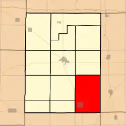 Location in Hamilton County | |
 Hamilton County's location in Illinois | |
| Coordinates: 37°58′43″N 88°25′47″W / 37.97861°N 88.42972°W | |
| Country | |
| State | |
| County | Hamilton |
| Established | November 3, 1885 |
| Area | |
| • Total | 54.75 sq mi (141.8 km2) |
| • Land | 54.6 sq mi (141 km2) |
| • Water | 0.15 sq mi (0.4 km2) 0.27% |
| Elevation | 364 ft (111 m) |
| Population (2010) | |
| • Estimate (2016)[1] | 466 |
| • Density | 8.9/sq mi (3.4/km2) |
| Time zone | UTC-6 (CST) |
| • Summer (DST) | UTC-5 (CDT) |
| ZIP codes | 62817, 62829, 62859 |
| FIPS code | 17-065-47657 |
Mayberry Township is one of twelve townships in Hamilton County, Illinois, USA. As of the 2010 census, its population was 486 and it contained 248 housing units.[2]
Geography
According to the 2010 census, the township has a total area of 54.75 square miles (141.8 km2), of which 54.6 square miles (141 km2) (or 99.73%) is land and 0.15 square miles (0.39 km2) (or 0.27%) is water.[2]
Cities, towns, villages
Unincorporated towns
- Nipper Corner at 38°02′19″N 88°28′13″W / 38.038659°N 88.470327°W
(This list is based on USGS data and may include former settlements.)
Extinct towns
- Rectorville at 37°55′18″N 88°27′28″W / 37.921714°N 88.457826°W
(These towns are listed as "historical" by the USGS.)
Cemeteries
The township contains these ten cemeteries: Albion, Big Hill, Clark, Cook, Gholson, Keasler, Lantham, Morris, New Prospect and Wolfe.
Demographics
| Census | Pop. | Note | %± |
|---|---|---|---|
| 2016 (est.) | 466 | [1] | |
| U.S. Decennial Census[3] | |||
School districts
- Eldorado Community Unit School District 4
- Hamilton County Community Unit School District 10
- Norris City-Omaha-Enfield Community Unit School District 3
Political districts
- Illinois's 15th congressional district
- State House District 118
- State Senate District 59
References
- "Mayberry Township, Hamilton County, Illinois". Geographic Names Information System. United States Geological Survey, United States Department of the Interior. Retrieved July 6, 2010.
- United States Census Bureau 2009 TIGER/Line Shapefiles
- United States National Atlas
- 1 2 "Population and Housing Unit Estimates". Retrieved June 9, 2017.
- 1 2 "Population, Housing Units, Area, and Density: 2010 - County -- County Subdivision and Place -- 2010 Census Summary File 1". United States Census. Archived from the original on February 12, 2020. Retrieved May 28, 2013.
- ↑ "Census of Population and Housing". Census.gov. Retrieved June 4, 2016.
External links
- City-Data.com
- Hamilton County Historical Society
- Illinois State Archives
- Mayberry Township History
- Township Officials of Illinois
Places adjacent to Mayberry Township, Hamilton County, Illinois | |
|---|---|
Municipalities and communities of Hamilton County, Illinois, United States | ||
|---|---|---|
| Cities | Map of Illinois highlighting Hamilton County | |
| Town | ||
| Villages | ||
| Townships | ||
| Unincorporated communities | ||
| Footnotes | ‡This populated place also has portions in an adjacent county or counties | |
This article is issued from Wikipedia. The text is licensed under Creative Commons - Attribution - Sharealike. Additional terms may apply for the media files.