Dalhunden
Dalhunde | |
|---|---|
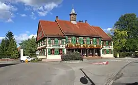 Town hall | |
.svg.png.webp) Coat of arms | |
Location of Dalhunden | |
 Dalhunden  Dalhunden | |
| Coordinates: 48°46′30″N 7°59′32″E / 48.775°N 7.9922°E | |
| Country | France |
| Region | Grand Est |
| Department | Bas-Rhin |
| Arrondissement | Haguenau-Wissembourg |
| Canton | Bischwiller |
| Intercommunality | Pays Rhénan |
| Government | |
| • Mayor (2020–2026) | Michel Degoursy[1] |
| Area 1 | 7.45 km2 (2.88 sq mi) |
| Population | 1,221 |
| • Density | 160/km2 (420/sq mi) |
| Time zone | UTC+01:00 (CET) |
| • Summer (DST) | UTC+02:00 (CEST) |
| INSEE/Postal code | 67082 /67770 |
| Elevation | 118–125 m (387–410 ft) |
| 1 French Land Register data, which excludes lakes, ponds, glaciers > 1 km2 (0.386 sq mi or 247 acres) and river estuaries. | |
Dalhunden (French pronunciation: [dalundən]) is a commune in the Bas-Rhin department and Grand Est region of north-eastern France.[3]
See also
References
- ↑ "Répertoire national des élus: les maires". data.gouv.fr, Plateforme ouverte des données publiques françaises (in French). 9 August 2021.
- ↑ "Populations légales 2021". The National Institute of Statistics and Economic Studies. 28 December 2023.
- ↑ INSEE commune file
Wikimedia Commons has media related to Dalhunden.
This article is issued from Wikipedia. The text is licensed under Creative Commons - Attribution - Sharealike. Additional terms may apply for the media files.