Truchtersheim | |
|---|---|
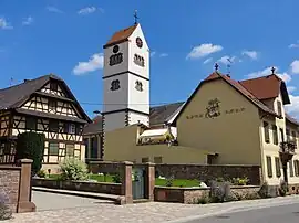 The church in Truchtersheim | |
.svg.png.webp) Coat of arms | |
Location of Truchtersheim | |
 Truchtersheim  Truchtersheim | |
| Coordinates: 48°39′49″N 7°36′27″E / 48.6636°N 7.6075°E | |
| Country | France |
| Region | Grand Est |
| Department | Bas-Rhin |
| Arrondissement | Saverne |
| Canton | Bouxwiller |
| Intercommunality | CC Kochersberg |
| Government | |
| • Mayor (2020–2026) | Justin Vogel[1] |
| Area 1 | 14.76 km2 (5.70 sq mi) |
| Population | 4,389 |
| • Density | 300/km2 (770/sq mi) |
| Time zone | UTC+01:00 (CET) |
| • Summer (DST) | UTC+02:00 (CEST) |
| INSEE/Postal code | 67495 /67370 |
| Elevation | 147–199 m (482–653 ft) |
| 1 French Land Register data, which excludes lakes, ponds, glaciers > 1 km2 (0.386 sq mi or 247 acres) and river estuaries. | |
Truchtersheim is a commune in the Bas-Rhin department in Grand Est in north-eastern France.[3] On 15 July 1974, Behlenheim was merged with Truchtersheim. On 1 January 2016, the former commune Pfettisheim was merged into Truchtersheim.[3][4]
Population
The population data given in the table below refer to the commune in its geography as of January 2023.
| Year | Pop. | ±% p.a. |
|---|---|---|
| 1968 | 1,199 | — |
| 1975 | 1,880 | +6.64% |
| 1982 | 2,413 | +3.63% |
| 1990 | 2,813 | +1.94% |
| 1999 | 3,125 | +1.18% |
| 2007 | 3,618 | +1.85% |
| 2012 | 3,746 | +0.70% |
| 2017 | 4,029 | +1.47% |
| Source: INSEE[5] | ||
See also
References
- ↑ "Répertoire national des élus: les maires". data.gouv.fr, Plateforme ouverte des données publiques françaises (in French). 2 December 2020.
- ↑ "Populations légales 2021". The National Institute of Statistics and Economic Studies. 28 December 2023.
- 1 2 Commune de Truchtersheim (67495), INSEE
- ↑ Arrêté préfectoral 3 December 2015 (in French)
- ↑ Population en historique depuis 1968, INSEE
External links
Wikimedia Commons has media related to Truchtersheim.
This article is issued from Wikipedia. The text is licensed under Creative Commons - Attribution - Sharealike. Additional terms may apply for the media files.