Denver City | |
|---|---|
| Denver City, Texas | |
 Denver City, Texas | |
| Nickname: DC | |
| Motto(s): "A Forest of Steel Giants Against the Daylight Sky", Paul W. Scott | |
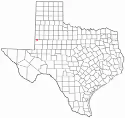
 Location of Denver City, Texas | |
 | |
| Coordinates: 32°57′52″N 102°49′45″W / 32.9645°N 102.8291°W | |
| Country | United States |
| State | Texas |
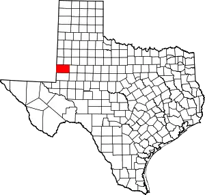
| Counties | Yoakum |
| Area | |
| • Total | 2.53 sq mi (6.56 km2) |
| • Land | 2.53 sq mi (6.56 km2) |
| • Water | 0.00 sq mi (0.00 km2) |
| Elevation | 3,573 ft (1,089 m) |
| Population (2010) | |
| • Total | 4,479 |
| • Estimate (2019)[3] | 4,911 |
| • Density | 1,939.57/sq mi (748.96/km2) |
| Time zone | UTC-6 (Central (CST)) |
| • Summer (DST) | UTC-5 (CDT) |
| ZIP code | 79323 |
| Area code | 806 |
| FIPS code | 48-19984[4] |
| GNIS feature ID | 2412419[2] |
| Website | https://denvercitytexas.org/ |
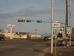
Denver City is a city located in Yoakum County in the far western portion of the U.S. state of Texas, just a short distance from the New Mexico boundary. It is named for the petroleum company Denver Productions. The population was 4,479 at the 2010 census. The city is located at the intersection of Texas State Highways 214 and 83.
History
Denver City traces its origins to the development of the Wasson oil pool. Oil leasing activities in the area trace back to 1927, gaining momentum with a significant strike in 1935. In 1939, C. S. Ameen and Ben Eggink founded the town, combining "Denver" from Denver Productions, where Ameen's friend worked, with "City" to express confidence in its future.[5][6]
Incorporated on March 26, 1940, Denver City swiftly organized its governance with a mayor and city council. The city established the Denver City Volunteer Fire Department, ordering a fire truck, and forming utility services, such as a water company and gas company.[5]
In 2008, the Denver City Independent School District presented a bond package for new and renovated facilities. Upgrades included a new high school, tennis courts, a junior-high band hall, an industrial arts facility, a sports complex, a maintenance center, an athletics field house, and a bus barn. Renovations included classrooms, science labs, offices and foyer, a parking lot, a main field house, and a bus barn for the junior-high campus.[7]
On May 11, 2013, voters in both Denver City and Yoakum County, as well as Crosby County, also in West Texas, all previously under local-option prohibition laws, approved the sale of liquor.[8]
Geography
Denver City is located at 32°58′07″N 102°49′52″W / 32.968580°N 102.831218°W (32.968580, −102.831218).[9]
According to the United States Census Bureau, Denver City has a total area of 2.5 square miles (6.5 km2), all land.
Climate
| Climate data for Denver City, Texas (1991–2020 normals, extremes 1986–present) | |||||||||||||
|---|---|---|---|---|---|---|---|---|---|---|---|---|---|
| Month | Jan | Feb | Mar | Apr | May | Jun | Jul | Aug | Sep | Oct | Nov | Dec | Year |
| Record high °F (°C) | 83 (28) |
89 (32) |
94 (34) |
98 (37) |
107 (42) |
113 (45) |
109 (43) |
109 (43) |
104 (40) |
99 (37) |
88 (31) |
82 (28) |
113 (45) |
| Mean daily maximum °F (°C) | 55.9 (13.3) |
60.8 (16.0) |
68.7 (20.4) |
76.7 (24.8) |
83.9 (28.8) |
91.8 (33.2) |
92.6 (33.7) |
91.3 (32.9) |
84.6 (29.2) |
76.4 (24.7) |
64.8 (18.2) |
56.6 (13.7) |
75.3 (24.1) |
| Daily mean °F (°C) | 41.3 (5.2) |
45.1 (7.3) |
52.3 (11.3) |
59.9 (15.5) |
68.8 (20.4) |
77.2 (25.1) |
79.0 (26.1) |
77.9 (25.5) |
71.1 (21.7) |
61.4 (16.3) |
50.0 (10.0) |
42.2 (5.7) |
60.5 (15.8) |
| Mean daily minimum °F (°C) | 26.8 (−2.9) |
29.4 (−1.4) |
36.0 (2.2) |
43.2 (6.2) |
53.8 (12.1) |
62.6 (17.0) |
65.4 (18.6) |
64.5 (18.1) |
57.6 (14.2) |
46.5 (8.1) |
35.2 (1.8) |
27.8 (−2.3) |
45.7 (7.6) |
| Record low °F (°C) | 6 (−14) |
−2 (−19) |
8 (−13) |
20 (−7) |
29 (−2) |
46 (8) |
55 (13) |
52 (11) |
37 (3) |
15 (−9) |
8 (−13) |
1 (−17) |
−2 (−19) |
| Average precipitation inches (mm) | 0.68 (17) |
0.77 (20) |
1.10 (28) |
1.21 (31) |
2.01 (51) |
2.27 (58) |
2.45 (62) |
2.44 (62) |
2.74 (70) |
1.63 (41) |
1.00 (25) |
0.75 (19) |
19.05 (484) |
| Average snowfall inches (cm) | 1.2 (3.0) |
0.9 (2.3) |
0.1 (0.25) |
0.0 (0.0) |
0.0 (0.0) |
0.0 (0.0) |
0.0 (0.0) |
0.0 (0.0) |
0.0 (0.0) |
0.0 (0.0) |
0.8 (2.0) |
1.9 (4.8) |
4.9 (12) |
| Average precipitation days (≥ 0.01 in) | 3.1 | 3.5 | 4.0 | 2.7 | 5.0 | 5.3 | 4.9 | 5.1 | 5.4 | 4.9 | 3.6 | 3.6 | 51.1 |
| Average snowy days (≥ 0.1 in) | 0.8 | 0.7 | 0.1 | 0.0 | 0.0 | 0.0 | 0.0 | 0.0 | 0.0 | 0.0 | 0.4 | 1.1 | 3.1 |
| Source: NOAA[10][11] | |||||||||||||
Demographics
| Census | Pop. | Note | %± |
|---|---|---|---|
| 1950 | 1,858 | — | |
| 1960 | 4,302 | 131.5% | |
| 1970 | 4,133 | −3.9% | |
| 1980 | 4,704 | 13.8% | |
| 1990 | 5,145 | 9.4% | |
| 2000 | 3,985 | −22.5% | |
| 2010 | 4,479 | 12.4% | |
| 2019 (est.) | 4,911 | [3] | 9.6% |
| U.S. Decennial Census[12] | |||
2020 census
| Race | Number | Percentage |
|---|---|---|
| White (non-Hispanic) | 1,156 | 25.86% |
| Black or African American (non-Hispanic) | 45 | 1.01% |
| Native American | 12 | 0.27% |
| Asian | 44 | 0.98% |
| Other/Mixed | 68 | 1.52% |
| Hispanic or Latino | 3,145 | 70.36% |
As of the 2020 United States census, there were 4,470 people, 1,516 households, and 1,012 families residing in the town.
2010 census
As of the census of 2010, 4,479 people, 1,770 households, and 1,578 families resided in the town. The racial makeup of the town was 31.2% White, 1.3% African American, 1% Native American, 0.6% Asian, 63.3% Hispanic or Latino, 0.1 Cuban, and 2.5% from two or more races. Of the 1,770 households, 27.5% had children under the age of 18 living with them, 63.8% were married couples living together, 10.5% had a female householder with no husband present, and 20.4% were not families. About 22.6% had someone living alone who was 65 years of age or older. The average household size was 2.96 and the average family size was 3.27.
In the town, the population was distributed as 34% up to age 19, 5.8% from 20 to 24, 25.7% from 25 to 44, 23.1% from 45 to 64, and 11.5% who were 65 years of age or older. The median age was 32.2 years of age.
According to a 2017 survey, the median income for a household in the town was $52,232, and for a family was $67,630. Males had a median income of $65,495 versus $23,346 for females. The per capita income for the town was $21,297. About 15.8% of families and 16.1% of the population were below the poverty line, including 19% of those under age 18 and 35% of those age 65 or over.
Notable people
- Chip Bennett, former NFL player with the Cincinnati Bengals
- Mario Lopez, Saved by the Bell star and TV personality
References
- ↑ "2019 U.S. Gazetteer Files". United States Census Bureau. Retrieved August 7, 2020.
- 1 2 U.S. Geological Survey Geographic Names Information System: Denver City, Texas
- 1 2 "Population and Housing Unit Estimates". United States Census Bureau. May 24, 2020. Retrieved May 27, 2020.
- ↑ "U.S. Census website". United States Census Bureau. Retrieved January 31, 2008.
- 1 2 "History". Denver City, Texas. Retrieved December 20, 2023.
- ↑ Bennett, Leoti A. "Denver City, TX". Handbook of Texas. Texas State Historical Association. Retrieved December 20, 2023.
- ↑ "Denver City Independent School District Bond Information". www.dcisd.org. Retrieved March 12, 2019.
- ↑ "Voters approve sales of alcohol in three elections". Lubbock Avalanche-Journal, May 12, 2013. Retrieved May 13, 2013.
- ↑ "US Gazetteer files: 2010, 2000, and 1990". United States Census Bureau. February 12, 2011. Retrieved April 23, 2011.
- ↑ "NOWData - NOAA Online Weather Data". National Oceanic and Atmospheric Administration. Retrieved December 20, 2023.
- ↑ "Summary of Monthly Normals 1991-2020". National Oceanic and Atmospheric Administration. Retrieved December 20, 2023.
- ↑ "Census of Population and Housing". Census.gov. Retrieved June 4, 2015.
- ↑ "Explore Census Data". data.census.gov. Retrieved December 24, 2021.

