Division No. 16 | |
|---|---|
| Country | Canada |
| Province | Alberta |
| Area | |
| • Total | 97,255 km2 (37,550 sq mi) |
| As of 2011 | |
| Population (2011)[1] | |
| • Total | 67,516 |
| • Density | 0.69/km2 (1.8/sq mi) |
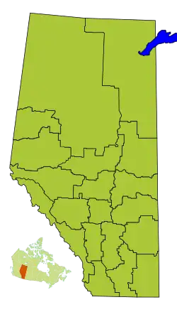
Division No. 16 is a census division in Alberta, Canada. It is located in the northeast portion of northern Alberta and surrounds the Urban Service Area of Fort McMurray.
Census subdivisions
The following census subdivisions (municipalities or municipal equivalents) are located within Alberta's Division No. 16.[2][3]
- Specialized municipalities
- Improvement districts
- Improvement District No. 24 (Wood Buffalo National Park)
- Indian reserves
- Allison Bay 219
- Charles Lake 225
- Chipewyan 201
- Chipewyan 201A
- Chipewyan 201B
- Chipewyan 201C
- Chipewyan 201D
- Chipewyan 201E
- Chipewyan 201F
- Chipewyan 201G
- Clearwater 175
- Collin Lake 223
- Cornwall Lake 224
- Devil's Gate 220
- Dog Head 218
- Fort McKay 174
- Gregoire Lake 176
- Gregoire Lake 176A
- Janvier 194
- Namur Lake 174B
- Namur River 174A
- Old Fort 217
- Sandy Point 221
- Thabacha Náre 196A
- Thebathi 196
- Indian settlements
- Fort Mackay
Demographics
In the 2021 Census of Population conducted by Statistics Canada, Division No. 16 had a population of 74,543 living in 26,592 of its 31,233 total private dwellings, a change of 0.8% from its 2016 population of 73,988. With a land area of 94,072.31 km2 (36,321.52 sq mi), it had a population density of 0.8/km2 (2.1/sq mi) in 2021.[4]
See also
References
- 1 2 "Population and dwelling counts, for Canada, provinces and territories, and census divisions, 2011 and 2006 censuses (Alberta)". Statistics Canada. February 8, 2012. Retrieved February 16, 2012.
- ↑ "2006 Community Profiles, Geographic hierarchy – Division No. 16 (Census division)". Statistics Canada. December 7, 2010. Retrieved August 30, 2011.
- ↑ "2022 Municipal Codes" (PDF). Alberta Municipal Affairs. January 5, 2022. Retrieved January 21, 2022.
- ↑ "Population and dwelling counts: Canada and census divisions". Statistics Canada. February 9, 2022. Retrieved April 2, 2022.
Places adjacent to Division No. 16, Alberta | ||||||||||||||||
|---|---|---|---|---|---|---|---|---|---|---|---|---|---|---|---|---|
| ||||||||||||||||
Subdivisions of Alberta | |
|---|---|
| Subdivisions | |
| Communities | |
| Cities and urban service areas | |
| Census divisions | |
| |
56°44′24″N 111°25′48″W / 56.74000°N 111.43000°W
This article is issued from Wikipedia. The text is licensed under Creative Commons - Attribution - Sharealike. Additional terms may apply for the media files.