Durfort-Lacapelette | |
|---|---|
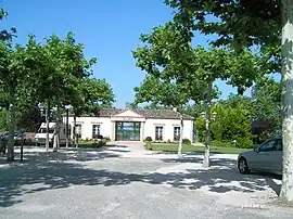 Durfort-Lacapelette town hall | |
Location of Durfort-Lacapelette | |
 Durfort-Lacapelette  Durfort-Lacapelette | |
| Coordinates: 44°11′14″N 1°09′20″E / 44.1872°N 1.1556°E | |
| Country | France |
| Region | Occitania |
| Department | Tarn-et-Garonne |
| Arrondissement | Castelsarrasin |
| Canton | Pays de Serres Sud-Quercy |
| Government | |
| • Mayor (2020–2026) | Dominique Forneris[1] |
| Area 1 | 35.83 km2 (13.83 sq mi) |
| Population | 843 |
| • Density | 24/km2 (61/sq mi) |
| Time zone | UTC+01:00 (CET) |
| • Summer (DST) | UTC+02:00 (CEST) |
| INSEE/Postal code | 82051 /82390 |
| Elevation | 91–205 m (299–673 ft) (avg. 195 m or 640 ft) |
| 1 French Land Register data, which excludes lakes, ponds, glaciers > 1 km2 (0.386 sq mi or 247 acres) and river estuaries. | |
Durfort-Lacapelette (French pronunciation: [dyʁfɔʁ lakaplɛt]; Languedocien: Durfòrt e la Capeleta) is a commune in the Tarn-et-Garonne department in the Occitanie region in southern France.
Geography
The Barguelonne river forms all of the commune's northern border.
See also
References
- ↑ "Répertoire national des élus: les maires" (in French). data.gouv.fr, Plateforme ouverte des données publiques françaises. 13 September 2022.
- ↑ "Populations légales 2021". The National Institute of Statistics and Economic Studies. 28 December 2023.
Wikimedia Commons has media related to Durfort-Lacapelette.
This article is issued from Wikipedia. The text is licensed under Creative Commons - Attribution - Sharealike. Additional terms may apply for the media files.