Saint-Projet | |
|---|---|
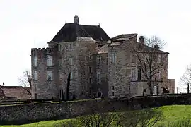 The Château of Saint-Projet | |
Location of Saint-Projet | |
 Saint-Projet  Saint-Projet | |
| Coordinates: 44°18′18″N 1°47′38″E / 44.305°N 1.7939°E | |
| Country | France |
| Region | Occitania |
| Department | Tarn-et-Garonne |
| Arrondissement | Montauban |
| Canton | Quercy-Rouergue |
| Intercommunality | Quercy Rouergue et des Gorges de l'Aveyron |
| Government | |
| • Mayor (2020–2026) | Christian Frauciel[1] |
| Area 1 | 26.14 km2 (10.09 sq mi) |
| Population | 281 |
| • Density | 11/km2 (28/sq mi) |
| Time zone | UTC+01:00 (CET) |
| • Summer (DST) | UTC+02:00 (CEST) |
| INSEE/Postal code | 82172 /82160 |
| Elevation | 213–402 m (699–1,319 ft) (avg. 384 m or 1,260 ft) |
| 1 French Land Register data, which excludes lakes, ponds, glaciers > 1 km2 (0.386 sq mi or 247 acres) and river estuaries. | |
Saint-Projet (French pronunciation: [sɛ̃ pʁɔʒɛ]; Occitan: Sent Progèt) is a commune in the Tarn-et-Garonne department in the Occitanie region in southern France.
History
Found in the area are traces of Gallo-Roman culture at a place called Grand-Cartayrou which it is claimed could be a Roman camp.[3]
See also
References
- ↑ "Répertoire national des élus: les maires" (in French). data.gouv.fr, Plateforme ouverte des données publiques françaises. 13 September 2022.
- ↑ "Populations légales 2021". The National Institute of Statistics and Economic Studies. 28 December 2023.
- ↑ reference needed
Wikimedia Commons has media related to Saint-Projet (Tarn-et-Garonne).
This article is issued from Wikipedia. The text is licensed under Creative Commons - Attribution - Sharealike. Additional terms may apply for the media files.