Durganagar | |
|---|---|
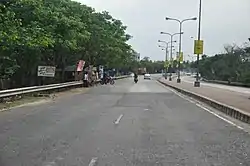
 Belghoria Expressway, Durganagar | |
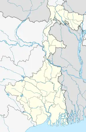
 Durganagar Location in West Bengal, India  Durganagar Durganagar (India) | |
| Coordinates: 22°39′10″N 88°25′11″E / 22.65266°N 88.4197°E | |
| Country | |
| State | West Bengal |
| District | North 24 Parganas |
| Region | Greater Kolkata |
| Metro Station | Biman Bandar(under construction), Dum Dum Cantonment(under construction) and Baranagar |
| Government | |
| • Type | Municipality |
| • Body | North Dumdum Municipality and Dumdum Municipality |
| Languages | |
| • Official | Bengali, English |
| Time zone | UTC+5:30 (IST) |
| PIN | 700028, 700065, 700079 |
| Telephone code | +91 33 |
| Vehicle registration | WB |
| Lok Sabha constituency | Dum Dum |
| Vidhan Sabha constituency | Dum Dum Uttar |
| Website | north24parganas |
Durganagar is a locality in North Dumdum of North 24 Parganas District in the Indian state of West Bengal. It was named after the goddess Durga. It is a part of area under jurisdiction of Kolkata Metropolitan Development Authority (KMDA). Kolkata Airport is located nearby.
Nimta and Dum Dum police stations under the Barrackpore Police Commissionerate have jurisdiction over North Dumdum Municipal area.[1][2]
Durganagar is 6.2 km (3.9 mi) from Dakshineswar Kali Temple and 1 kilometre (0.62 mi) west of Netaji Subhash Chandra Bose International Airport, Kolkata.
Kolkata Urban Agglomeration
The following Municipalities, Census Towns and other locations in Barrackpore, subdivision were part of Kolkata Urban Agglomeration in the 2011 census:[3]
- Kanchrapara (M)
- Jetia (CT)
- Halisahar (M),
- Balibhara (CT)
- Naihati (M)
- Bhatpara (M)
- Kaugachhi (CT)
- Garshyamnagar (CT)
- Garulia (M)
- Ichhapur Defence Estate (CT)
- North Barrackpur (M)
- Barrackpur Cantonment (CB
- Barrackpore (M)
- Jafarpur (CT)
- Ruiya (CT)
- Titagarh (M)
- Khardaha (M)
- Bandipur (CT)
- Panihati (M)
- Muragachha (CT)
- New Barrackpore (M)
- Chandpur (CT)
- Talbandha (CT)
- Patulia (CT)
- Kamarhati (M)
- Baranagar (M)
- South Dumdum (M)
- North Dumdum (M)
- Dum Dum (M)
- Noapara (CT)
- Babanpur (CT)
- Teghari (CT)
- Nanna (OG)
- Chakla (OG)
- Srotribati (OG)
- Panpur (OG)
Geography
Durganagar (West) has been a part of the North Dum Dum Municipality since 2000, while Durganagar (East) belongs to Dum Dum Municipality. Previously it was known as Sultanpur. Durganagar area situated in the Northern Suburbs of the Kolkata Metropolitan area. Its population is about 50,000. Most of the people are Hindu. About 200–300 Muslims reside in its eastern side.
This place is almost pollution-free in North Dumdum with much green all around. Facilities are adequate, with almost everything nearby. But this environment existed ten years ago, now many flats and buildings are constructed by destroying many playgrounds and ponds. Many trees have been cut down for the construction.
The sudden increase in the population has taken place mainly people from an outsider are settling here because of its proximity to Kolkata Airport (around seven minutes). Durganagar also has good transportation facilities, with good roadways and a local railway section. Durganagar has seen its boost up to access easier transporting communication by means of Belghoria Expressway which runs nearby. Durganagar is connected to Kolkata Airport by bus, taxi, rickshaws, auto-rickshaws, and toto-rickshaws.
Climate
The climate is tropical — like the rest of the Gangetic West Bengal. The hallmark is the monsoon — from early June to mid September. The weather remains dry during the winter (mid-November to mid-February) and humid during summer.
Temperature: 40 °C in May (max) and 10 °C in January (min)
Relative humidity: between 55% in March & 98% in July
Rainfall: 1,579 mm (Normal)
Economy
The locality is near Kolkata International Airport. Durganagar also has good transportation facilities, with roadways and a local railway section.
It has its own post office, Allahabad Bank, AXIS Bank ATM, HDFC ATM, SBI Bank with ATM and UBI Bank with ATM a market and several playgrounds. Almost the whole population is constituted by 4-5 member small families with a single earning member. Many of them are servicemen (state/central govt. jobs), people working in IT industries and Doctors and Engineers. Residents commute daily via local train or by Durganagar Bus stop (Belghoria Expressway also Called Delhi Road) or by autoride to Kolkata International Airport.
There are many local markets on the area. Gorabazar, one of the biggest markets around Kolkata, is situated nearby (eight minutes to Gorabazar). Another big market Nagerbazar is also close to the locality (proximity to go 18 minutes).
Transport
Durganagar also has good transportation facilities, with good roadways and Kolkata Suburban Railway's service (Durganagar railway station). Durganagar has seen its boost up to access easier transporting communication by means of Belghoria Expressway which runs along the northern boundary of Durganagar. Anybody from Durganagar easily go to Howrah Station, Bally Halt, Dankuni, Kona Expressway, Dunlop, Dakhineswar, Dumdum/Kolkata Airport, Madhyamgram, Rajharhat-New Town, Saltlake (Karunamoyee, Sector-V) and different other places through bus, taxi and other vehicles pling on this road. Other areas' people also access this road to different places from its bus stops Sreenagar–Durganagar and Badra–Durganagar. The locality is near Kolkata International Airport (around seven minutes).
Bus
Private Bus
- 285 Serampore/Bally Ghat railway station - Salt Lake Sector-V
- DN2/1 Dakshineswar - New Town Shapoorji Housing Estate
- DN44 Dakshineswar - Bangaon
- DN46 Dankuni Housing - Salt Lake Karunamoyee
WBTC Bus
- C23 Dankuni Housing - Park Circus
- S23A Rajchandrapur - Salt Lake Karunamoyee
- AC2B Belgharia Rathtala - Jadavpur Sulekha
- AC23A Rajchandrapur - Salt Lake Karunamoyee
- AC50 Belur Math - Garia
- AC50A Rajchandrapur - Garia
Many unnumbered shuttle buses also pass through Durganagar along Belghoria Expressway.[4]
Education
Durganagar has no colleges. The schools are Bengali Medium and English Medium. Prominent schools include:
- Durganagar High School
- Nepal Chandra School
- Khalisakota Adarsha Balika Vidyalaya
- Swarnamayee High School
- Nalta Mahajati High School
Culture
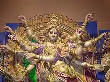
Durganagar is named after the goddess Durga. Almost 3–4 Durga Pujas pandels are set up during the main festive season. The two main ancient Pujas at Durganagar are "Durganagar adibasi brinda", the first is set up at the main (Durganagar sporting club) playground near Durganagar X Roads (Chou Rasta) it is organized by Durganagar Sporting Club and the second is Uttar Durganagar Odibasi brinda, Kolkata:-65 Club set up at the (Saraj Sisu Uddan) near Saha Katgola is mainly organised by the members of Bandhu Milon sangha.

The Durga Pujas now been taken by Kali Pujas. Every summer there is a carnival in the Sporting Club.
People
- Bhaskar Ganguly and ex-goalkeeper of Indian football team.
Sports

Football (soccer) is a passion of all citizens, and home of the goalkeeper Bhaskar Ganguly. Football practice and training is often happening in the ground morning and evening. Cricket and karate practice also done by the club on its play ground.
References
- ↑ "District Statistical Handbook". North 24 Parganas 2013, Table 2.1. Department of Statistics and Programme Implementation, Government of West Bengal. Retrieved 11 June 2018.
- ↑ "Barrackpore Police Commissionerate". List of Police Stations with telephone numbers. West Bengal Police. Retrieved 11 June 2018.
- ↑ "Provisional Population Totals, Census of India 2011" (PDF). Constituents of Urban Agglomeration Having Population Above 1 Lakh. Census of India 2011. Retrieved 7 June 2018.
- ↑ Google maps
External links
 Kolkata/Northern fringes travel guide from Wikivoyage
- Satellite view
