Eggersdorf bei Graz | |
|---|---|
 | |
 Coat of arms | |
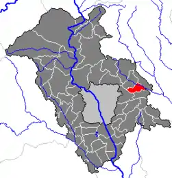 Location within Graz-Umgebung district | |
 Eggersdorf bei Graz Location within Austria | |
| Coordinates: 47°07′22″N 15°35′57″E / 47.12278°N 15.59917°E | |
| Country | Austria |
| State | Styria |
| District | Graz-Umgebung |
| Government | |
| • Mayor | Johann Zaunschirm (ÖVP) |
| Area | |
| • Total | 49.21 km2 (19.00 sq mi) |
| Elevation | 410 m (1,350 ft) |
| Population (2018-01-01)[2] | |
| • Total | 6,620 |
| • Density | 130/km2 (350/sq mi) |
| Time zone | UTC+1 (CET) |
| • Summer (DST) | UTC+2 (CEST) |
| Postal code | 8063 |
| Area code | 03117 |
| Vehicle registration | GU |
| Website | www.eggersdorf-graz.at |
Eggersdorf bei Graz is a municipality in the district of Graz-Umgebung in the Austrian state of Styria.
Population
| Year | Pop. | ±% |
|---|---|---|
| 1869 | 1,051 | — |
| 1880 | 1,098 | +4.5% |
| 1890 | 1,147 | +4.5% |
| 1900 | 1,147 | +0.0% |
| 1910 | 1,023 | −10.8% |
| 1923 | 1,205 | +17.8% |
| 1934 | 1,318 | +9.4% |
| 1939 | 1,261 | −4.3% |
| 1951 | 1,152 | −8.6% |
| 1961 | 1,218 | +5.7% |
| 1971 | 1,364 | +12.0% |
| 1981 | 1,450 | +6.3% |
| 1991 | 1,713 | +18.1% |
| 2001 | 1,918 | +12.0% |
References
- ↑ "Dauersiedlungsraum der Gemeinden Politischen Bezirke und Bundesländer - Gebietsstand 1.1.2018". Statistics Austria. Retrieved 10 March 2019.
- ↑ "Einwohnerzahl 1.1.2018 nach Gemeinden mit Status, Gebietsstand 1.1.2018". Statistics Austria. Retrieved 9 March 2019.
This article is issued from Wikipedia. The text is licensed under Creative Commons - Attribution - Sharealike. Additional terms may apply for the media files.