Fehérgyarmat | |
|---|---|
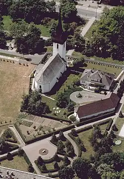 Aerial photo: Fehérgyarmat Church | |
 Flag  Coat of arms | |
 Fehérgyarmat  Fehérgyarmat | |
| Coordinates: 47°59′06″N 22°31′02″E / 47.98500°N 22.51722°E | |
| Country | |
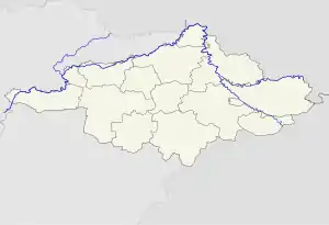
| County | Szabolcs-Szatmár-Bereg |
| District | Fehérgyarmat |
| Area | |
| • Total | 52.46 km2 (20.25 sq mi) |
| Population (2015) | |
| • Total | 8,089[1] |
| • Density | 154.3/km2 (400/sq mi) |
| Time zone | UTC+1 (CET) |
| • Summer (DST) | UTC+2 (CEST) |
| Postal code | 4900 |
| Area code | (+36) 44 |
| Website | fehergyarmat |
Fehérgyarmat is a town in Szabolcs-Szatmár-Bereg county, in the Northern Great Plain region of eastern Hungary.
Geography
It covers an area of 52.46 km2 (20 sq mi) and has a population of 8089 people (2015).[1]
Twin towns – sister cities
Fehérgyarmat is twinned with:[2]
 Nisko, Poland
References
- 1 2 Gazetteer of Hungary, 1 January 2015. Hungarian Central Statistical Office. 3 September 2015
- ↑ "Miasta Partnerskie". nisko.pl (in Polish). Gmina Nisko. Retrieved 2 April 2021.
External links
Wikimedia Commons has media related to Fehérgyarmat.
- Official website in Hungarian
| Town (1) |
| |
|---|---|---|
| Large villages (2) | ||
| Villages (47) |
| |


This article is issued from Wikipedia. The text is licensed under Creative Commons - Attribution - Sharealike. Additional terms may apply for the media files.