Formerie | |
|---|---|
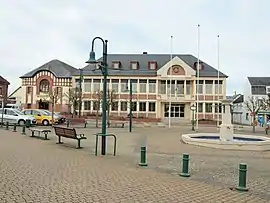 The town hall in Formerie | |
 Coat of arms | |
Location of Formerie | |
 Formerie  Formerie | |
| Coordinates: 49°39′04″N 1°43′50″E / 49.6511°N 1.7306°E | |
| Country | France |
| Region | Hauts-de-France |
| Department | Oise |
| Arrondissement | Beauvais |
| Canton | Grandvilliers |
| Intercommunality | Picardie Verte |
| Government | |
| • Mayor (2020–2026) | William Bous[1] |
| Area 1 | 12.82 km2 (4.95 sq mi) |
| Population | 2,105 |
| • Density | 160/km2 (430/sq mi) |
| Time zone | UTC+01:00 (CET) |
| • Summer (DST) | UTC+02:00 (CEST) |
| INSEE/Postal code | 60245 /60220 |
| Elevation | 203–229 m (666–751 ft) |
| 1 French Land Register data, which excludes lakes, ponds, glaciers > 1 km2 (0.386 sq mi or 247 acres) and river estuaries. | |
Formerie (French pronunciation: [fɔʁməʁi]) is a commune in the Oise department in northern France. On 1 January 2019, the former commune Boutavent was merged into Formerie.[3] Formerie station has rail connections to Amiens and Rouen.
Population
| Year | Pop. | ±% p.a. |
|---|---|---|
| 1968 | 2,044 | — |
| 1975 | 2,141 | +0.66% |
| 1982 | 2,249 | +0.71% |
| 1990 | 2,260 | +0.06% |
| 1999 | 2,246 | −0.07% |
| 2007 | 2,173 | −0.41% |
| 2012 | 2,185 | +0.11% |
| 2017 | 2,131 | −0.50% |
| Source: INSEE[4] | ||
See also
References
- ↑ "Répertoire national des élus: les maires". data.gouv.fr, Plateforme ouverte des données publiques françaises (in French). 2 December 2020.
- ↑ "Populations légales 2021". The National Institute of Statistics and Economic Studies. 28 December 2023.
- ↑ Arrêté préfectoral 28 September 2018, p. 16 (in French)
- ↑ Population en historique depuis 1968, INSEE
Wikimedia Commons has media related to Formerie.
This article is issued from Wikipedia. The text is licensed under Creative Commons - Attribution - Sharealike. Additional terms may apply for the media files.