Fort Lancaster | |
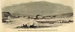
 Illustration of Fort Lancaster in Harper's Weekly, 1861 | |
 Fort Lancaster  Fort Lancaster | |
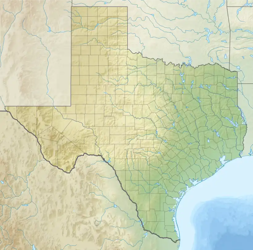
| Location | Crockett County, Texas |
|---|---|
| Nearest city | Sheffield, Texas |
| Coordinates | 30°39′58″N 101°41′46″W / 30.66611°N 101.69611°W |
| Area | 39 acres (16 ha) |
| Built | 1855 |
| NRHP reference No. | 71000928 |
| TSAL No. | 8200000190 |
| Significant dates | |
| Added to NRHP | March 11, 1971 |
| Designated TSHS | April 16, 1968 |
| Designated TSAL | February 22, 1983 |
Fort Lancaster is a former United States Army installation located near Sheffield, Texas. The fort was established in 1855 on the San Antonio–El Paso Road to protect migrants moving toward California through Texas. The US Army occupied Fort Lancaster until Texas seceded from the United States in March 1861 and were replaced at the fort by forces loyal to the Confederate States of America. The Confederate Army held the fort from November 1861 until April 1862, when it was again abandoned and then burned.
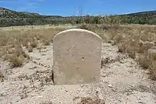
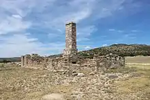
The 82-acre site, now operated by the Texas Historical Commission as Fort Lancaster State Historic Site, contains the ruins of 29 buildings that made up the fort and a visitor center with a museum.
Use as military outpost
Fort Lancaster was established during the American colonization of Texas in the 19th century,[1] a process that began in the 1820s with the immigration of Anglo-Americans into Spanish, later Mexican, Texas.[2] In 1836, an Anglo-American-dominated Texas seceded from Mexico and became a republic that was annexed into the United States a decade later.[3] That annexation provoked a war between Mexico and the United States in 1848 that the latter won, enabling the US to annex what is now the Southwestern United States.[4]
The 1849 discovery of gold in California, one of the annexed territories, was the catalyst for an unprecedented migration of white settlers across Texas.[5] They moved along such routes as the San Antonio–El Paso Road (also called the Military Road),[6] through territory traversed by the Comanche, Kiowa, and Lipan Apache peoples,[7] who vigorously resisted colonization.[8] To protect the settlers, the US Army established two lines of forts across Texas from 1848 to 1852.[9] Along the Military Road were, from east to west, Forts Inge, Clark, Davis, and Bliss. Between Forts Clark and Davis, however, was 300 miles (480 km) of wilderness.[7] To close that gap, General Persifor Frazer Smith, commander of the Department of Texas, ordered on July 20, 1855, that an outpost be established where the Military Road crossed the Pecos River.[10]
Occupation by the US Army, 1855–1861
To carry out Smith's orders, two companies of the 1st Infantry Regiment under the command of Captain Stephen Decatur Carpenter departed Fort Duncan on August 7, 1855.[11] On August 20, 1855, Carpenter arrived at Live Oak Creek,[12] 4 miles (6.4 km) from the Military Road's crossing over the Pecos,[13] and established Camp Lancaster. On August 21, 1856, the outpost was made a permanent US Army installation with the name Fort Lancaster.[12] Its garrison was charged with patrolling the Military Road and policing the frontier. As infantrymen, sometimes mounted on mules, the garrison was ineffective at stopping raiding by mounted indigenous war parties.[14]

The first structures at Fort Lancaster were jacales, huts with wood or earth walls with canvas roofs, and prefabricated buildings brought by wagon and assembled on-site. In June 1856, Colonel Joseph K. Mansfield inspected Camp Lancaster and described it as being composed mostly of jacales. According to a letter by the post's quartermaster from May 1857,[15] which described the fort as having a "half-finished appearance",[16] there were five permanent officers' residences and two kitchens and attached mess halls, built of stone and adobe bricks, with four permanent enlisted men's barracks under construction. Construction of these and other buildings, which was complicated by a lack of readily available nearby lumber,[17] lasted until 1860.[18]
On July 9, 1857, a caravan of 40 men, 25 camels, and over a hundred sheep led by Edward Fitzgerald Beale,[18] a former US Navy lieutenant,[19] arrived at Fort Lancaster. The caravan, part of a US Army unit formed in 1855 to test the feasibility of using camels as pack animals on the American frontier,[20] had encamped at a creek 2 miles (3.2 km) from Fort Lancaster. At the invitation of the fort's officers, Beale's caravan stayed the night at Fort Lancaster, then departed the next day.[21][22] A second caravan of camels arrived at the fort in June 1860.[12]
Use by Confederate Texas, 1861–1865
On March 2, 1861, Texas seceded from the United States to join the Confederate States of America.[23] On 4 February, as it moved the state towards secession, the Texas Secession Convention demanded the surrender of all federal garrisons and property in the state.[24] Brevet Major General David E. Twiggs, commander of the Department of Texas since 1857,[25] capitulated. He issued orders on February 24 and 27, 1861, for the garrisons of the forts along the Military Road to abandon their billets and march to the Gulf Coast for evacuation from Texas.[26] Fort Lancaster's garrison departed on March 19, 1861,[27] and were replaced by a company of Confederate troops.[12] On November 28, 1861, Confederate general Henry Hopkins Sibley arrived at Fort Lancaster as he was following the Military Road towards the New Mexico Territory,[28] which he hoped to invade and capture for the Confederacy. The campaign was a failure. After being defeated at the Battle of Glorieta Pass in March 1862, Sibley's force retreated.[29] Pursued by Federal forces, the Confederates abandoned the forts of the Military Road;[30] Fort Lancaster's garrison departed on April 2, 1862.[31] The fort itself was at around this time destroyed by fire, either by the retreating Confederates or by indigenous peoples.[32]
Use by the US Army, 1867–1873
When the Civil War ended, the U.S. Army occupied Texas; Texas was under U.S. Army administration until 1875. During the occupation, several other frontier forts were established in Texas. Various companies of the 9th Cavalry rotated through Fort Lancaster and gradually the outpost was rebuilt. These soldiers escorted stagecoaches westward and fought skirmishes with Apaches. In December 1867, the U.S. 9th Cavalry's Company K, a unit of African-American cavalrymen with White commissioned officers, was stationed at the fort. These were seasoned "horse soldiers", including Civil War veteran noncommissioned officers. Largely because White cavalry units objected to designating them as "U.S. Cavalry", they were furnished with "saddle mules" and horses inferior to those of other U.S. cavalry units; sometimes they were issued outdated arms and other such second-rate equipment. Despite their equally dangerous and arduous duties, they were officially called "mounted infantry". A motto ascribed to them was "forty miles a day on beans and hay". On December 26, 1867, a large band of Kickapoo and Comanchero raiders attacked the fort to steal horses. The company repelled the attack, but lost 38 horses and mules. Some of the raiders returned two days later; they were unsuccessful in taking the remaining animals.[33]
Archeology

Within 40 years after being built, the wooden-frame superstructures of some buildings at the fort burned. "Only a few partially extant walls, a chimney, and numerous wall foundations remained in 1912."[34] This was the general condition of the site when the first scientific archeological investigations were conducted in 1966.[35] Archeological excavations were again conducted in 1971,[36] when the site was mapped and test excavations were done.[37] Archeological investigations in 1974[38] revealed that officers' quarters buildings had wood-plank floors, thresholds, and doorjambs fitted with iron pintels; the assumption is that doors were also of wood. These carbonized remains were left in situ after being exposed during archeological investigations, photographed, and recorded by measured drawings using grid systems tied to "modern" architectural features of the park facilities. The excavation units were stabilized by careful backfilling with soil removed from those units to protect the remains for anticipated future public display. Subsequent archeology in 1975 and 1976 revealed that wooden superstructure and flooring of site's commanding officer's residence and the sutler's store had likewise been destroyed by fire. Architectural details of buildings investigated by archeological excavation 1974-1976[39] indicate that before the buildings burned, they were all similar in design and construction, as would be expected of military engineering.
Preservation
The ruins of Fort Lancaster were deeded in 1965 to the Crockett County government, which ceded it three years later to the Texas Parks and Wildlife Department (TPWD).[12] The fort was added to the National Register of Historic Places on March 11, 1971.[40]
TPWD architects attempted the first interpretative restoration at the site with modern cement mortar to stabilize the remaining stone walls and cement-fortified adobes to simulate the original plain-mud adobes of the enlisted men's mess-hall. Associated with the 1974–1976 archeological investigations and as a preservation measure the archeologists in 1976 made adobes from untempered mud dug on site with hand tools. These adobes, sized to duplicate the original adobe bricks, were laid atop remaining original adobe walls at some of the officer's quarters on the north side of the parade ground.[39] Remains of these adobes still formed a protective preservative layer as late as April, 2010.[41] A budget shortfall prompted the state to yield management of the site to Texas Rural Communities, Incorporated, in 1993. On January 1, 2008, operational control of the site was transferred from TPWD to the Texas Historical Commission, which now manages preservation and public visitation of the site.
See also
References
- ↑ Field 2006, p. 6.
- ↑ Handbook of Texas Online: Anglo-American Colonization.
- ↑ Handbook of Texas Online: Annexation.
- ↑ Handbook of Texas Online: Mexican War.
- ↑ Alexander & Utley 2012, p. 34.
- ↑ Francell 1999, p. 25.
- 1 2 Meadows & Meadows 1997, p. 22.
- ↑ Alexander & Utley 2012, pp. 33–35.
- ↑ Field 2006, pp. 4–5.
- ↑ Francell 1999, p. 32.
- ↑ Francell 1999, pp. 32–33.
- 1 2 3 4 5 Handbook of Texas Online: Fort Lancaster.
- ↑ Uglow 2001, p. 26.
- ↑ Francell 1999, p. 31.
- ↑ Francell 1999, pp. 34–35, 42–44, 48–49.
- ↑ University of Texas 1968, p. 12.
- ↑ Francell 1999, pp. 48–49.
- 1 2 Alexander & Utley 2012, p. 42.
- ↑ Francell 1999, p. 29.
- ↑ Handbook of Texas Online: Camels.
- ↑ Francell 1999, pp. 49–50.
- ↑ Alexander & Utley 2012, p. 42–43.
- ↑ Handbook of Texas Online: Secession.
- ↑ Handbook of Texas Online: Secession Convention.
- ↑ Handbook of Texas Online: Twiggs, David Emanuel.
- ↑ Francell 1999, p. 60.
- ↑ Frazer 1965, p. 153.
- ↑ Alexander & Utley 2012, pp. 43–44.
- ↑ Handbook of Texas Online: Sibley Campaign.
- ↑ Francell 1999, p. 61.
- ↑ University of Texas 1968, p. 14.
- ↑ Meadows & Meadows 1997, p. 24.
- ↑ Wayne R. Austerman, "African American Troops of Company K, 9th Cavalry Fought in the Battle of Fort Lancaster" HistoryNet.com; additional cites in preparation
- ↑ Osborne, 1975, op cit
- ↑ T.R. Hays and Edward B. Jelks, 1966, Archeological Exploration at Fort Lancaster, 1966, A Preliminary report. State Building Commission Archeological Program Report 4. Austin, Texas
- ↑ John W. Clark, Jr., 1972, Archeological Investigations at Fort Lancaster State Historic Site, Crockett County, Texas. Texas Archaeological Salvage Project Research Report No. 12. The University of Texas, Austin
- ↑ Dessamae Lorraine, 1971, “Daily Log”, Field Notes of Fall 1971 Excavations on File at Texas Parks and Wildlife Department, Historic Sites and Restoration Branch, Austin
- ↑ Art Black, 1975, op cit
- 1 2 Wayne Roberson et al, 1974, 1975 and 1976, Field notes, drawings, and photographs on file at Texas Parks and Wildlife Department, Austin
- ↑ National Park Service 1969, p. 5.
- ↑ Wayne Roberson, personal observation, April, 2010
Further reading
- "Fort Lancaster (National Register of Historic Places Inventory – Nomination)" (PDF). National Park Service. July 1969.
- University of Texas at Austin School of Architecture (1968). Lancaster. Texas Historic Forts. Vol. III. Texas Parks and Wildlife Department. OCLC 1081419.
Books and articles
- Alexander, Thomas E.; Utley, Dan K. (2012). Faded Glory: A Century of Forgotten Texas Military Sites, Then and Now. Texas A&M University Press. ISBN 978-1-60344-699-0.
- Field, Ron (2006). Forts of the American Frontier 1820–91: The Southern Plains and Southwest. Fortress. Osprey Publishing. ISBN 978-1-84603-040-6.
- Francell, Lawrence J. (1999). Fort Lancaster. Texas State Historical Association. ISBN 978-0-87611-173-4.
- Frazer, Robert Walter (1965). Forts of the West: Military Forts and Presidios, and Posts Commonly Called Forts, West of the Mississippi River to 1898. University of Oklahoma Press. ISBN 9780806112503.
- Meadows, Henry E.; Meadows, John B. (1997). "Fort Lancaster: Worst Station in Texas or a Very Romantic Place?". Texas Heritage. Texas Historical Foundation. 15 (3): 22–24. Retrieved December 30, 2021.
- Uglow, Loyd (2001). Standing in the Gap: Army Outposts, Picket Stations, and the Pacification of the Texas Frontier, 1866–1886. Texas Christian University Press. ISBN 978-0-87565-246-7.
Texas State Historical Association
- Alberts, Don E. "Sibley Campaign". Handbook of Texas Online. Retrieved February 19, 2022.
- Bauer, K. Jack. "Mexican War". Handbook of Texas Online. Retrieved February 10, 2022.
- Buenger, Walter L. "Secession Convention". Handbook of Texas Online. Retrieved October 28, 2021.
- Buenger, Walter L. "Secession". Handbook of Texas Online. Retrieved February 18, 2022.
- Clark, John. W. Jr. "Fort Lancaster". Handbook of Texas Online. Retrieved December 30, 2021.
- Cutrer, Thomas W.; Smith, David Paul. "Twiggs, David Emanuel". Handbook of Texas Online. Retrieved September 29, 2021.
- Emmett, Chris; Faulk, Odie B. "Camels". Handbook of Texas Online. Retrieved February 17, 2022.
- Henson, Margaret S. "Anglo-American Colonization". Handbook of Texas Online. Retrieved February 9, 2022.
- Neu, C. T. "Annexation". Handbook of Texas Online. Retrieved February 10, 2022.