Francavilla Marittima | |
|---|---|
| Comune di Francavilla Marittima | |
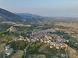 Aerial view of Francavilla Marittima | |
Location of Francavilla Marittima | |
 Francavilla Marittima Location of Francavilla Marittima in Italy 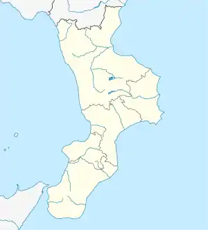 Francavilla Marittima Francavilla Marittima (Calabria) | |
| Coordinates: 39°49′1″N 16°23′44″E / 39.81694°N 16.39556°E | |
| Country | Italy |
| Region | Calabria |
| Province | Cosenza (CS) |
| Government | |
| • Mayor | Franco Bettarini |
| Area | |
| • Total | 33.02 km2 (12.75 sq mi) |
| Elevation | 273 m (896 ft) |
| Population (31 August 2017)[2] | |
| • Total | 2,870 |
| • Density | 87/km2 (230/sq mi) |
| Demonym | Francavillesi of Francavillari |
| Time zone | UTC+1 (CET) |
| • Summer (DST) | UTC+2 (CEST) |
| Postal code | 87072 |
| Dialing code | 0981 |
| Patron saint | St. Cajetan |
| Saint day | 7 August |
| Website | Official website |
Francavilla Marittima is a town and comune in the province of Cosenza in the Calabria region of southern Italy. It is known for the Timpone della Motta, a hill which was the site of an Oenotrian and ancient Greek settlement and sanctuary.
References
- ↑ "Superficie di Comuni Province e Regioni italiane al 9 ottobre 2011". Italian National Institute of Statistics. Retrieved 16 March 2019.
- ↑ Demographics data from ISTAT
This article is issued from Wikipedia. The text is licensed under Creative Commons - Attribution - Sharealike. Additional terms may apply for the media files.