Gao County
高县 | |
|---|---|
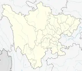 Gaoxian Location of the seat in Sichuan | |
| Coordinates: 28°26′10″N 104°31′05″E / 28.436°N 104.518°E | |
| Country | People's Republic of China |
| Province | Sichuan |
| Prefecture-level city | Yibin |
| Area | |
| • County | 1,323 km2 (511 sq mi) |
| Population (2019) | 526,400 |
| • Urban | 171,000 |
| • Rural | 355,400 |
| Time zone | UTC+8 (China Standard) |
| Website | www |
Gao County or Gaoxian (simplified Chinese: 高县; traditional Chinese: 高縣; pinyin: Gāo Xiàn) is a county of Sichuan Province, China. It is under the administration of Yibin city and has a population of 526,400 in 2019, 171,000 of which live in the urban area. The county seat is located 48 km from Yibin city. The county is traversed by the Nanguang River (zh:南广河), a tributary of the Yangtze. About half of the land area is covered by forests.[1]
On 20 March 1994, 18 people were killed by a landslide in the east of Gao County.[2][3]
Administrative divisions
Gao County administers 13 towns:
- Qingfu
- Wenjiang
- Yuejiang
- Shahe
- Jiaocun
- Luochang
- Shengtian
- Laifu
- Kejiu
- Jiale
- Xiaxing
- Luorun
- Qingling
Climate
| Climate data for Gaoxian (1991–2020 normals, extremes 1981–2010) | |||||||||||||
|---|---|---|---|---|---|---|---|---|---|---|---|---|---|
| Month | Jan | Feb | Mar | Apr | May | Jun | Jul | Aug | Sep | Oct | Nov | Dec | Year |
| Record high °C (°F) | 20.6 (69.1) |
24.1 (75.4) |
31.4 (88.5) |
34.8 (94.6) |
38.3 (100.9) |
37.2 (99.0) |
38.4 (101.1) |
41.2 (106.2) |
40.1 (104.2) |
31.4 (88.5) |
26.5 (79.7) |
20.7 (69.3) |
41.2 (106.2) |
| Mean daily maximum °C (°F) | 11.0 (51.8) |
14.0 (57.2) |
18.9 (66.0) |
24.6 (76.3) |
27.9 (82.2) |
29.6 (85.3) |
32.2 (90.0) |
32.1 (89.8) |
27.5 (81.5) |
22.0 (71.6) |
17.9 (64.2) |
12.3 (54.1) |
22.5 (72.5) |
| Daily mean °C (°F) | 8.0 (46.4) |
10.3 (50.5) |
14.3 (57.7) |
19.2 (66.6) |
22.6 (72.7) |
24.8 (76.6) |
27.0 (80.6) |
26.7 (80.1) |
23.1 (73.6) |
18.5 (65.3) |
14.3 (57.7) |
9.4 (48.9) |
18.2 (64.7) |
| Mean daily minimum °C (°F) | 6.0 (42.8) |
7.7 (45.9) |
11.1 (52.0) |
15.4 (59.7) |
18.7 (65.7) |
21.4 (70.5) |
23.4 (74.1) |
23.1 (73.6) |
20.3 (68.5) |
16.3 (61.3) |
12.1 (53.8) |
7.5 (45.5) |
15.3 (59.4) |
| Record low °C (°F) | −1.7 (28.9) |
0.2 (32.4) |
1.7 (35.1) |
6.0 (42.8) |
10.5 (50.9) |
15.5 (59.9) |
16.7 (62.1) |
16.9 (62.4) |
13.8 (56.8) |
6.5 (43.7) |
2.9 (37.2) |
−1.8 (28.8) |
−1.8 (28.8) |
| Average precipitation mm (inches) | 16.7 (0.66) |
18.0 (0.71) |
31.4 (1.24) |
59.3 (2.33) |
78.8 (3.10) |
137.2 (5.40) |
190.4 (7.50) |
204.1 (8.04) |
106.5 (4.19) |
59.7 (2.35) |
25.1 (0.99) |
16.0 (0.63) |
943.2 (37.14) |
| Average precipitation days (≥ 0.1 mm) | 13.4 | 11.2 | 13.7 | 13.5 | 14.7 | 17.5 | 15.5 | 14.3 | 15.8 | 18.6 | 12.8 | 13.4 | 174.4 |
| Average snowy days | 0.2 | 0.1 | 0 | 0 | 0 | 0 | 0 | 0 | 0 | 0 | 0 | 0.1 | 0.4 |
| Average relative humidity (%) | 83 | 80 | 77 | 75 | 74 | 80 | 81 | 81 | 83 | 86 | 84 | 84 | 81 |
| Mean monthly sunshine hours | 35.7 | 48.5 | 88.6 | 123.6 | 126.8 | 107.5 | 162.5 | 167.0 | 92.4 | 53.1 | 55.7 | 37.8 | 1,099.2 |
| Percent possible sunshine | 11 | 15 | 24 | 32 | 30 | 26 | 38 | 41 | 25 | 15 | 17 | 12 | 24 |
| Source: China Meteorological Administration[4][5] | |||||||||||||
References
- ↑ "走进高县".
- ↑ "A COLLAPSE LANDSLIDE OF MARCH 20.1904 AT BAIYA,GAOXIAN COUNTY,SICHUAN PROVINCE--《MOUNTAIN RESEARCH》1994年04期". en.cnki.com.cn. Retrieved 2021-02-09.
- ↑ 中國新聞 (in Chinese). 中囯新闻社. March 1994.
- ↑ 中国气象数据网 – WeatherBk Data (in Simplified Chinese). China Meteorological Administration. Retrieved 14 April 2023.
- ↑ 中国气象数据网 (in Simplified Chinese). China Meteorological Administration. Retrieved 14 April 2023.
This article is issued from Wikipedia. The text is licensed under Creative Commons - Attribution - Sharealike. Additional terms may apply for the media files.