| Grand Scenic Divide | |
|---|---|
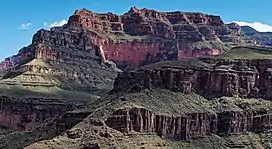
 North aspect | |
| Highest point | |
| Elevation | 5,667 ft (1,727 m)[1] |
| Prominence | 87 ft (27 m)[1] |
| Parent peak | Fossil Mountain (6,729 ft)[1] |
| Isolation | 1.04 mi (1.67 km)[1] |
| Coordinates | 36°12′18″N 112°21′24″W / 36.2050822°N 112.3566503°W[2] |
| Geography | |
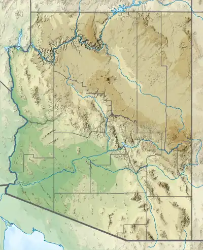
 Grand Scenic Divide Location in Arizona  Grand Scenic Divide Grand Scenic Divide (the United States) | |
| Location | Grand Canyon National Park Coconino County, Arizona, US |
| Parent range | Coconino Plateau Colorado Plateau |
| Topo map | USGS Havasupai Point |
| Geology | |
| Type of rock | sandstone, limestone, shale |
| Climbing | |
| Easiest route | class 2 hiking |
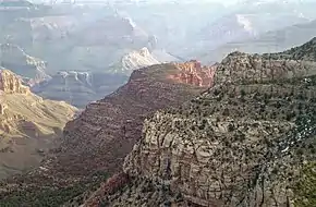
Grand Scenic Divide is a 5,667-foot-elevation (1,727-meter) ridge located in the Grand Canyon, in Coconino County of northern Arizona, Southwestern United States.[2] It is situated immediately north of Fossil Mountain, and 1.5 mile east of Mount Huethawali. Surrounded by Bass and Serpentine Canyons, topographic relief is significant as it rises over 3,400 feet (1,000 meters) above the nearby Colorado River in 1.5 mile. It is composed of strata of the Pennsylvanian-Permian Supai Group. Further down are strata of the cliff-forming Mississippian Redwall Limestone, and Cambrian Tonto Group.[3] According to the Köppen climate classification system, Grand Scenic Divide is located in a cold semi-arid climate zone.[4] The normal approach to the ridge is made via the South Bass Trail, and from the top the view includes Masonic Temple, Holy Grail Temple, Dox Castle, King Arthur Castle, Evans Butte, Sagittarius Ridge, and Scorpion Ridge.
Etymology
The Grand Scenic Divide is so named because it is here where the Grand Canyon markedly changes in geologic and scenic character. To the east are the isolated towers, buttes, temples, and side canyons which are the essence of its visual appeal, and to the west an absence of such striking scenery.[5] This natural line of demarcation also happens to be where the granite of the inner gorge disappears, such that buttes did not form once the river flowed only through the sedimentary rocks.[6] This geographical feature's name was applied by William Wallace Bass, and later officially adopted in 1932 by the U.S. Board on Geographic Names.[2][7]
Dick Pillar
Dick Pillar is a red sandstone pinnacle at the northeast tip of Grand Scenic Divide.[8] It is unofficially named after Scottish geologist Robert Dick, whose work contributed to the progress of understanding Grand Canyon rock.[9]

See also
References

from the southwest at Bass Trail
- 1 2 3 4 "Grand Scenic Divide - 5,667' AZ". Lists of John. Retrieved March 4, 2021.
- 1 2 3 "Grand Scenic Divide". Geographic Names Information System. United States Geological Survey, United States Department of the Interior. Retrieved 2021-03-04.
- ↑ N.H. Darton, Story of the Grand Canyon of Arizona, 1917, page 69.
- ↑ Peel, M. C.; Finlayson, B. L.; McMahon, T. A. (2007). "Updated world map of the Köppen−Geiger climate classification". Hydrol. Earth Syst. Sci. 11 (5): 1633. Bibcode:2007HESS...11.1633P. doi:10.5194/hess-11-1633-2007. ISSN 1027-5606.
- ↑ George Wharton James, In and Around the Grand Canyon, 1900, Little, Brown, and Company, page 95.
- ↑ George Wharton James, The Grand Canyon of Arizona How to See It, 1910, Little Brown and Company, page 59.
- ↑ George Wharton James, In and Around the Grand Canyon, 1900, Little, Brown, and Company, p. 95.
- ↑ Byrd H. Granger, Grand Canyon Place Names, 1960, University of Arizona Press Tucson, page 10.
- ↑ George Wharton James, In and Around the Grand Canyon, 1900, Little, Brown, and Company, p. 96.
External links
- Weather forecast: National Weather Service
- Dick Pillar photo