| Grizzly Mountain | |
|---|---|
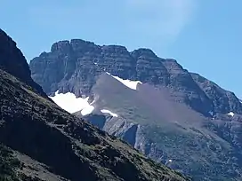 Grizzly Mountain as seen from Two Medicine Lake | |
| Highest point | |
| Elevation | 9,072 ft (2,765 m)[1] |
| Prominence | 1,707 ft (520 m)[1] |
| Coordinates | 48°25′07″N 113°24′07″W / 48.4185767°N 113.4020435°W[2] |
| Geography | |
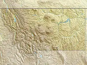 Grizzly Mountain Location in Montana  Grizzly Mountain Location in the United States | |
| Location | Glacier County, Montana, Flathead County, Montana, U.S. |
| Parent range | Lewis Range |
| Topo map | USGS Mount Rockwell |
| Climbing | |
| Easiest route | Scramble |
Grizzly Mountain (9,072 feet (2,765 m)) is located in the Lewis Range, Glacier National Park in the U.S. state of Montana.[3] Grizzly Mountain sits astride the Continental Divide in the Two Medicine region of Glacier National Park.
See also
References
- 1 2 "Grizzly Mountain, Montana". Peakbagger.com. Retrieved August 2, 2017.
- ↑ "Grizzly Mountain". Geographic Names Information System. United States Geological Survey, United States Department of the Interior. Retrieved August 2, 2017.
- ↑ Mount Rockwell, MT (Map). TopoQwest (United States Geological Survey Maps). Retrieved August 2, 2017.
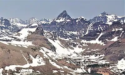
Aerial view of Grizzly Mountain (centered).
Red Crow Mountain (lower left), and Mount Rockwell (upper right).
Camera pointed northwest.
Red Crow Mountain (lower left), and Mount Rockwell (upper right).
Camera pointed northwest.
This article is issued from Wikipedia. The text is licensed under Creative Commons - Attribution - Sharealike. Additional terms may apply for the media files.