Harburn is a small village and estate in West Lothian, Scotland.[1][2] It lies approximately 2 miles south-east of West Calder and just to the north of the Pentland Hills.
The Harburn estate is a 19th century landscaped park and country house estate, primarily laid out in 1808.[3][1] Harburn House is a Category B listed 18th century country-house that was built in 1804 for Alexander Young (1757-1842), factor to the Duke of Hamilton.[3][4][5] It replaced an early property, Hayfield House and there are also records of a Harburn Castle, recorded as being fortified during Cromwell's invasions.[3][1] [6] The stables are also early 19th century and are Category B listed. [7]
In 1832, King Charles X of France visited Harburn and a monument to his visit, in the form of a stone column was erected.[8]
Culture
Harburn village hill is a local community facility that was built in 1923 as a gift to the community from King George V for the villages contribution to the war effort at the nearby gunpowder mill.[9]
Harburn golf course is an 18 golf course on the western edge of Harburn that was created in its present location in 1932.[10]
Camilty

Camilty is a plantation and forest area on the southern and eastern edge of Harburn. The area produces trees for sale as christmas trees.[11] Permission was given in 2021 for a six large wind turbines to be built on the plantation.[12]
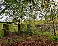
Camilty Gunpowder mill is a large ruined powder mill on private land near the Harburn estate that produced explosives, primarily for blasting in the local shale industry.[13][14] In the First World War the facility produced munitions and armaments.[9] The mill was in production from 1890 to 1929 and was operated by Midlothian Gunpowder Company.[13] It was later owned by Curtis and Harvey and then passed to Nobel Enterprises before being closed following a period of decline in shale mining. The mill was powered by a weir built at the end of the 19th century.[13]
Castle Greg is located on the southern edge of Harburn. The castle is the archaeological remains of an Roman fortlet.[15]
Transport
The Caledonian Railway line, built circa 1850, cuts through the north-west boundary of the Harburn Estate.[3] The nearest railway station is West Calder railway station. The B7008 forms the south-west boundary of Harburn.[3] The A70 road connecting Edinburgh with Lanark lies to the south-east of Harburn.
References
- 1 2 3 Historic Environment Scotland. "Harburn Estate (48999)". Canmore. Retrieved 24 October 2021.
- ↑ "Harburn, West Lothian". The Gazetteer for Scotland. School of GeoSciences, University of Edinburgh and The Royal Scottish Geographical Society. Retrieved 24 October 2021.
- 1 2 3 4 5 Historic Environment Scotland. "HARBURN HOUSE (GDL00208)". Retrieved 24 October 2021.
- ↑ Jaques and McKean (1 September 1994). West Lothian - An Illustrated Architectural Guide. Scotland: The Rutland Press. ISBN 978-1873190258.
- ↑ Historic Environment Scotland. "Harburn House (212698)". Canmore. Retrieved 24 October 2021.
- ↑ Historic Environment Scotland. "HARBURN HOUSE (HAYFIELD) (LB14215)". Retrieved 24 October 2021.
- ↑ Historic Environment Scotland. "HARBURN STABLES (LB14217)". Retrieved 24 October 2021.
- ↑ Historic Environment Scotland. "CHARLES X MONUMENT, HARBURN POLICIES (Category B Listed Building) (LB14216)". Retrieved 24 October 2021.
- 1 2 "History". Harburn Village Hall. Retrieved 22 October 2021.
- ↑ "History". Harburn Golf Club. Retrieved 24 October 2021.
- ↑ "'I can't leave people without a tree at Christmas'". BBC News. Retrieved 24 October 2021.
- ↑ "Turbines nearly as tall as Blackpool Tower to be erected on the fringe of Pentlands Hills". Edinburgh Evening News. Retrieved 22 October 2021.
- 1 2 3 Meighan, Michael (2012). Scotland's Lost Industries. Amberley Publishing Ltd. ISBN 9781445624013.
- ↑ Camilty Gunpowder Works. West Lothian Local History Library. 2009.
- ↑ Historic Environment Scotland. "Castle Greg (48988)". Canmore. Retrieved 24 October 2021.