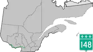
Route 148 | ||||
|---|---|---|---|---|
 | ||||
| Route information | ||||
| Maintained by Transports Québec | ||||
| Length | 318 km[1] (198 mi) | |||
| History | ||||
| Major junctions | ||||
| West end | ||||
| East end | ||||
| Location | ||||
| Country | Canada | |||
| Province | Quebec | |||
| Highway system | ||||
| ||||

Route 148 is an east-west highway in Quebec, Canada. It runs from junction of Autoroute 13 and Autoroute 440 in Laval in the Montreal region to the Ontario-Quebec border in L'Isle-aux-Allumettes in western Quebec. For most of its length, Route 148 follows the north shore of the Ottawa River where it acted as the principal route between communities in the Outaouais region until the completion of Autoroute 50 in 2012. At the Ontario-Quebec border in L'Isle-aux-Allumettes Route 148 continues into Ontario as Highway 148.
In Gatineau, Route 148 is concurrent with Autoroute 50 from Maloney Boulevard until the terminus of Autoroute 50 at des Allumettières Boulevard. Route 148 then continues west on des Allumettières Boulevard towards Aylmer. Prior to the opening of des Allumettières Boulevard in 2007, Route 148 was concurrent with Autoroute 5 between the Autoroute 50 junction and Saint-Raymond Boulevard.
The section of Route 148 between Lachute and Buckingham was the only major route on the north shore of the Ottawa River between communities in the eastern Outaouais region and Gatineau and Montreal. This section, especially the section between Masson-Angers and Montebello, has been the site of numerous fatal accidents over the last few years. Construction of Autoroute 50 to the north of Route 148 was completed on November 26, 2012, and now provides a faster and safer route between communities in the eastern Outaouais region and Gatineau and Mirabel.
For many years Route 148 included a section of Rue Principale west of A-13 and most of Boulevard Saint-Martin in Laval.[2]
Municipalities along Route 148
Municipalities listed in order from west to east:
- L'Isle-aux-Allumettes
- Waltham
- Mansfield-et-Pontefract
- Fort Coulonge
- Litchfield
- Campbell's Bay
- Bryson
- Shawville
- Bristol
- Pontiac
- Gatineau - (Aylmer / Hull / Gatineau / Masson-Angers)
- Lochaber-Partie-Ouest
- Thurso
- Lochaber
- Plaisance
- Papineauville
- Montebello
- Notre-Dame-de-Bonsecours
- Fassett
- Grenville-sur-la-Rouge (Calumet)
- Brownsburg-Chatham
- Lachute
- Mirabel
- Saint-Eustache
- Laval - (Laval-Ouest / Sainte-Dorothée)
Major intersections
| RCM | Location | km[1] | mi | Exit | Destinations | Notes | |
|---|---|---|---|---|---|---|---|
| Rivière des Outaouais (Ottawa River) | 0.0– 1.6 | 0.0– 0.99 | Continuation into Ontario | ||||
| Pont Des Allumettes (Allumettes Bridge) (via Île Morrison) | |||||||
| Pontiac | L'Isle-aux-Allumettes – Waltham boundary | 16.9 | 10.5 | Crosses Chenal de la Culbute | |||
| Campbell's Bay | 54.3 | 33.7 | West end of R-301 concurrency | ||||
| Litchfield | 64.4 | 40.0 | East end of R-301 concurrency | ||||
| Shawville | 74.4 | 46.2 | East end of R-303 concurrency | ||||
| 75.8 | 47.1 | West end of R-303 concurrency | |||||
| Les Collines-de-l'Outaouais | Quyon | 98.7 | 61.3 | Ferry connection to Ottawa (to Ottawa City Road 7 (Ferry Road)) | |||
| Gatineau | 137.3 | 85.3 | Chemin Eardley / Boulevard des Allumettières | R-148 follows Boulevard des Allumettières | |||
| 146.6 | 91.1 | – | Boulevard Saint-Raymond | Interchange | |||
| 147.7 | 91.8 | – | Promenade de la Gatineau | Interchange | |||
| 148.1 | 92.0 | – | Promenade du Lac-des-Fées | Interchange; westbound exit and eastbound entrance | |||
| 148.4 | 92.2 | Rue Labelle | Roundabout | ||||
| 148.8 | 92.5 | Rue Demontigny | Roundabout | ||||
| 149.0 | 92.6 | Roundabout | |||||
| 149.4 | 92.8 | 134 | Boulevard des Allumettières – Pont Alexandra, Ottawa | West end of A-50 concurrency; exit numbers follow A-50; no access to A-50 west from R-148 east | |||
| 150.4– 151.4 | 93.5– 94.1 | 135 | A-5 exit 2; no westbound entrance | ||||
| 152.4 | 94.7 | Pont des Draveurs (Draveurs Bridge) crosses the Gatineau River | |||||
| 152.6 | 94.8 | 138 | |||||
| 153.5 | 95.4 | 139 | Eastbound exit and westbound entrance; east end of A-50 concurrency; R-148 follows Boulevard Maloney | ||||
| 155.1 | 96.4 | Boulevard Gréber | |||||
| 163.1 | 101.3 | ||||||
| 179.0 | 111.2 | ||||||
| 43.0 | 26.7 | Ferry connection to Cumberland (to Ottawa City Road 35) | |||||
| Papineau | Thurso | 194.4 | 120.8 | Ferry connection to Rockland (to Prescott and Russell County Road 8) | |||
| 195.3 | 121.4 | ||||||
| Papineauville | 212.6 | 132.1 | |||||
| Montebello | 219.6 | 136.5 | |||||
| Argenteuil | Grenville-sur-la-Rouge | 249.3 | 154.9 | ||||
| Brownsburg-Chatham | 265.0 | 164.7 | A-50 exit 254 | ||||
| Lachute | 270.4 | 168.0 | West end of R-327 concurrency | ||||
| 270.6 | 168.1 | East end of R-327 concurrency | |||||
| 271.2 | 168.5 | R-158 western terminus; west end of R-158 concurrency | |||||
| 273.3 | 169.8 | West end of R-329 concurrency | |||||
| 274.2 | 170.4 | East end of R-329 concurrency | |||||
| Mirabel | 283.1 | 175.9 | East end of R-158 concurrency | ||||
| 283.9 | 176.4 | A-50 exit 272 | |||||
| Deux-Montagnes | Saint-Eustache | 310.2 | 192.7 | A-640 exit 11 | |||
| 312.4 | 194.1 | ||||||
| Rivière des Mille Îles | 312.5– 312.9 | 194.2– 194.4 | Pont Arthur-Sauvé (Arthur Sauvé Bridge) | ||||
| Laval | 315.8 | 196.2 | Boulevard Arthur-Sauvé / Avenue des Bois | R-148 follows Avenue des Bois | |||
| 316.5 | 196.7 | Rue Princeipale | Former R-148 alignment | ||||
| 318.9 | 198.2 | R-148 eastern terminus; A-440 western terminus; continues as A-440 | |||||
| Former alignment via Rue Principale and Boulevard Saint-Marin[2] | |||||||
| 322.6 | 200.5 | Interchange; A-13 exit 12 | |||||
| 325.8 | 202.4 | ||||||
| 327.9 | 203.7 | Interchange; A-15 exit 8 | |||||
| 331.2 | 205.8 | ||||||
| 333.1 | 207.0 | Interchange; A-19 exit 7 | |||||
| 325.8 | 202.4 | Interchange; former R-148 eastern terminus | |||||
1.000 mi = 1.609 km; 1.000 km = 0.621 mi
| |||||||
Images
 Rte. 148 through Lochaber. |
 Route 148 as seen from the roadside rest stop in Litchfield. |
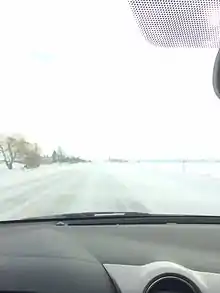 View on Route 148 east bound during snowstorm in Mirabel. |
 Western terminus, under construction, on Allumette Island |
See also
References
- 1 2 Google (May 13, 2023). "Quebec Route 148" (Map). Google Maps. Google. Retrieved May 13, 2023.
- 1 2 Ministère des Transports (2001). "Enlargement Southern Québec" (Map). Québec Official Road Map. 1:250000. Les Publications du Québec. Montréal and vicinity inset.