Hochwolkersdorf | |
|---|---|
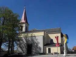 Hochwolkersdorf parish church | |
 Coat of arms | |
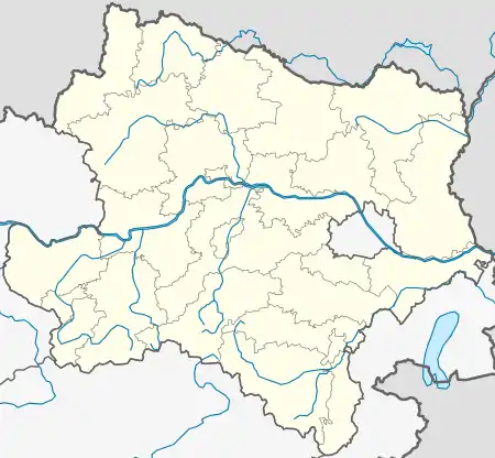 Hochwolkersdorf Location within Austria  Hochwolkersdorf Hochwolkersdorf (Austria) | |
| Coordinates: 47°39′37″N 16°16′56″E / 47.66028°N 16.28222°E | |
| Country | |
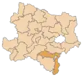
| State | Lower Austria |
| District | Wiener Neustadt-Land |
| Government | |
| • Burgermeisterin | Waltraud Gruber (SPÖ) |
| Area | |
| • Total | 23.54 km2 (9.09 sq mi) |
| Elevation | 630 m (2,070 ft) |
| Population (2018-01-01)[2] | |
| • Total | 1,004 |
| • Density | 43/km2 (110/sq mi) |
| Time zone | UTC+1 (CET) |
| • Summer (DST) | UTC+2 (CEST) |
| Postal code | 2802 |
| Area code | 02645 |
| Vehicle registration | WB |
| Website | www.hochwolkersdorf.at |
Hochwolkersdorf is a municipality in the district of Wiener Neustadt-Land in the Austrian state of Lower Austria.
Population
| Year | Pop. | ±% |
|---|---|---|
| 1869 | 995 | — |
| 1880 | 1,133 | +13.9% |
| 1890 | 1,143 | +0.9% |
| 1900 | 1,141 | −0.2% |
| 1910 | 1,273 | +11.6% |
| 1923 | 1,171 | −8.0% |
| 1934 | 1,058 | −9.6% |
| 1939 | 966 | −8.7% |
| 1951 | 928 | −3.9% |
| 1961 | 871 | −6.1% |
| 1971 | 989 | +13.5% |
| 1981 | 1,033 | +4.4% |
| 1991 | 1,029 | −0.4% |
| 2001 | 1,045 | +1.6% |
| 2011 | 1,016 | −2.8% |
References
- ↑ "Dauersiedlungsraum der Gemeinden Politischen Bezirke und Bundesländer - Gebietsstand 1.1.2018". Statistics Austria. Retrieved 10 March 2019.
- ↑ "Einwohnerzahl 1.1.2018 nach Gemeinden mit Status, Gebietsstand 1.1.2018". Statistics Austria. Retrieved 9 March 2019.
This article is issued from Wikipedia. The text is licensed under Creative Commons - Attribution - Sharealike. Additional terms may apply for the media files.