Kapas | |
|---|---|
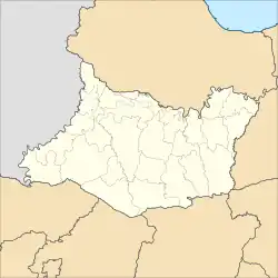 Kapas Location in Bojonegoro Regency | |
| Coordinates: 7°11′58″S 111°53′33″E / 7.1995°S 111.8926°E | |
| Country | |
| Province | East Java |
| Regency | Bojonegoro |
| Government | |
| • Camat | Sukirno, SSos, MSi |
| Area | |
| • Total | 46.38 km2 (17.91 sq mi) |
| Population (2020 Census)[1] | |
| • Total | 54,975 |
| • Density | 1,200/km2 (3,100/sq mi) |
| Time zone | UTC+7 Western Indonesian Time |
| Postcode | 62181 |
| Area code | +62 353 |
| Website | http://kapas.bojonegorokab.go.id |
Kapas is a district in Bojonegoro Regency, East Java, Indonesia. It borders Soko of Tuban Regency to the north, Balen to the east, Sukosewu to the south, and Bojonegoro to the west.[2] The village of Sukowati is the petroleum exploration site of Joint Operating Body Pertamina PetroChina East Java (JOB-PPEJ) as a part of Tuban Block.[3][4]
Administration
Kapas district is divided into 21 administrative villages (Indonesian: kelurahan, desa).
|
|
Transport
Roads
Indonesian National Route 20 runs from Babat to Caruban through Kapas.
Railways
Kapas is served by Kapas railway station which has once daily commuter service to Surabaya Pasar Turi, Surabaya Gubeng and Sidoarjo. More commuter and intercity rail services are provided at Bojonegoro railway station.
References
- ↑ Badan Pusat Statistik, Jakarta, 2021.
- ↑ "Kecamatan Kapas Kabupaten Bojonegoro".
- ↑ Sujatmiko. "PetroChina Akan Sedot Minyak di Bawah Alun-Alun Bojonegoro". Tempo (in Indonesian). Retrieved 3 December 2015.
- ↑ "Tuban Block in East Java". PetroChina International Companies in Indonesia. Archived from the original on 8 December 2015. Retrieved 3 December 2015.
This article is issued from Wikipedia. The text is licensed under Creative Commons - Attribution - Sharealike. Additional terms may apply for the media files.