Tuban Regency
Kabupaten Tuban | |
|---|---|
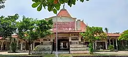 Kambang Terminal | |
 Coat of arms | |
| Motto(s): “Terwujudnya masyarakat Kabupaten Tuban yang mandiri dan sejahtera lahir batin “ (striving to make Tubanese society wholly independent and prosperous) | |
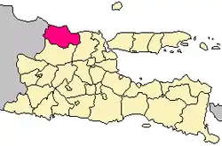 Location within East Java | |
| Coordinates: 6°53′S 112°03′E / 6.883°S 112.050°E | |
| Country | |
| Province | East Java |
| Anniversary | 12 November 1293 |
| Capital | Tuban |
| Government | |
| • Regent | Aditya Halindra Faridzky |
| • Vice Regent | Riyadi |
| Area | |
| • Total | 1,839.94 km2 (710.40 sq mi) |
| Population (mid 2022 estimate)[1] | |
| • Total | 1,209,543 |
| • Density | 660/km2 (1,700/sq mi) |
| Time zone | UTC+7 (IWST) |
| Area code | (+62) 356 |
| Website | tubankab |

Tuban Regency is a regency in the East Java province of Indonesia. The Dutch name of the regency is 'Toeban'. It covers an area of 1,839.94 sq. km, and had a population of 1,118,464 at the 2010 Census[2] and 1,198,012 at the 2020 Census;[3] the official estimate as of mid-2022 was 1,209,543 (comprising 603,875 males and 605,668 females).[1] The administrative centre is the coastal town of Tuban. The Regency is bordered to the north by the Java Sea, east by Lamongan Regency, south by Bojonegoro Regency, and west by Blora Regency and Rembang Regency (both in Central Java Province). The regency is located in a strategic area, on the border of East Java with Central Java, passed by the main highway (Jalan Nasional Daendels) along the north coast of Java (here called Jalur Pantai Utara or Jalur Pantura). In ancient times, Tuban was the main port of Majapahit and was a center of Islamic spreading by Walisongo.
Administrative districts
Tuban Regency consists of twenty districts (kecamatan), tabulated below with their areas and their population totals from the 2010 Census[2] and the 2020 Census,[3] together with the official estimates as of mid-2022.[1] The table also includes the locations of the district administrative centres, the number of administrative villages in each district (totaling 311 rural desa and 17 urban kelurahan), and their postal codes.
| Kode Wilayah | Name of District (kecamatan) | Area in km2 | Pop'n Census 2010 | Pop'n Census 2020 | Pop'n Estimate mid 2022 | Admin centre | No. of villages | Post codes |
|---|---|---|---|---|---|---|---|---|
| 35.23.01 | Kenduruan | 85.73 | 26,317 | 28,343 | 28,643 | Sidomukti | 9 | 62363 |
| 35.23.03 | Bangilan | 77.27 | 43,477 | 48,052 | 48,805 | Bangilan | 14 | 62364 |
| 35.23.05 | Senori | 78.39 | 38,373 | 41,653 | 42,158 | Sendang | 12 | 62365 |
| 35.23.07 | Singgahan | 79.05 | 39,193 | 41,345 | 41,616 | Mulyoagung | 12 | 62361 |
| 35.23.10 | Montong | 147.98 | 51,300 | 53,343 | 53,543 | Montongsekar | 13 | 62357 |
| 35.23.09 | Parengan | 114.45 | 51,546 | 53,603 | 53,804 | Parangbatu | 18 | 62366 |
| 35.23.11 | Soko | 96.88 | 78,667 | 83,814 | 84,525 | Sokosari | 23 | 62372 |
| 35.23.14 | Rengel | 58.52 | 56,388 | 59,306 | 59,660 | Rengel | 16 | 62370 |
| 35.23.20 | Grabagan | 73.79 | 36,406 | 39,040 | 39,420 | Grabagan | 11 | 62371 |
| 35.23.17 | Plumpang | 86.52 | 74,206 | 78,147 | 78,632 | Plumpang | 18 | 62382 |
| 35.23.19 | Widang | 107.14 | 47,413 | 48,726 | 48,797 | Widang | 16 | 62383 |
| 35.23.18 | Palang | 72.70 | 76,875 | 86,743 | 88,456 | Leran Kulon | 19 (a) | 62391 |
| 35.23.15 | Semanding | 120.99 | 101,336 | 114,136 | 116,347 | Bejagung | 17 (b) | 62381 |
| 35.23.16 | Tuban (town) | 21.29 | 81,982 | 84,542 | 84,722 | Latsari | 17 (c) | 62311 - 62319 |
| 35.23.12 | Jenu | 81.61 | 50,163 | 55,363 | 56,215 | Beji | 17 | 62352 |
| 35.23.13 | Merakurak | 103.77 | 54,293 | 58,781 | 59,464 | Sambonggede | 19 | 62355 |
| 35.23.08 | Kerek | 136.55 | 64,471 | 67,163 | 67,439 | Jarorejo | 17 | 62356 |
| 35.23.06 | Tambakboyo | 72.97 | 38,529 | 42,137 | 42,710 | Tambakboyo | 18 | 62353 |
| 35.23.02 | Jatirogo | 111.98 | 52,564 | 55,534 | 55,914 | Wotsogo | 18 | 62362 |
| 35.23.04 | Bancar | 112.36 | 54,965 | 58,241 | 58,673 | Bancar | 24 | 62354 |
| Totals | 1,839.94 | 1,118,464 | 1,198,012 | 1,209,543 | Tuban | 328 |
Notes: (a) including one kelurahan (Panyuran). (b) including 2 kelurahan (Gedongombo and Karang). (c) comprising 14 kelurahan (Baturetno, Doromukti, Karangsari, Kebonsari, Kingking, Kutorejo, Latsari, Mondokan, Perbon, Ronggomulyo, Sendangharjo, Sidomulyo, Sidorejo and Sukolilo) and 3 desa.